You are here: Home > Network List > US - United States National Seismic Network Stations List
> Station ELK Elko, Nevada, USA > Earthquake Result Viewer
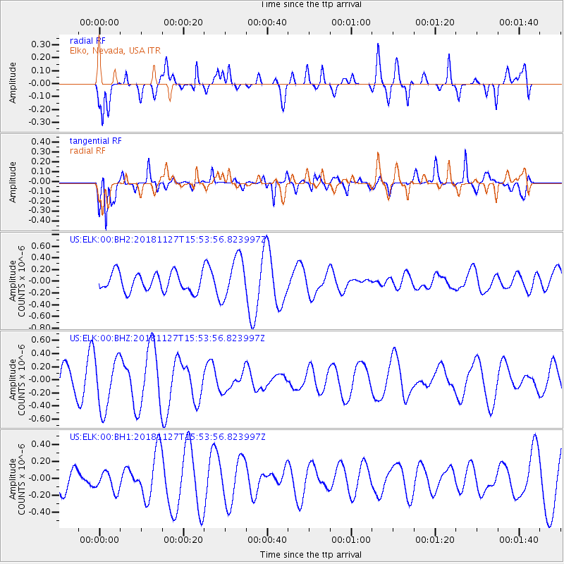
ELK Elko, Nevada, USA - Earthquake Result Viewer
*The percent match for this event was below the threshold and hence no stack was calculated.
| Earthquake location: |
Southeast Of Loyalty Islands |
| Earthquake latitude/longitude: |
-21.3/171.3 |
| Earthquake time(UTC): |
2018/11/27 (331) 15:41:20 GMT |
| Earthquake Depth: |
10 km |
| Earthquake Magnitude: |
5.8 Mww |
| Earthquake Catalog/Contributor: |
NEIC PDE/us |
|
| Network: |
US United States National Seismic Network |
| Station: |
ELK Elko, Nevada, USA |
| Lat/Lon: |
40.74 N/115.24 W |
| Elevation: |
2210 m |
|
| Distance: |
91.9 deg |
| Az: |
46.768 deg |
| Baz: |
243.377 deg |
| Ray Param: |
$rayparam |
*The percent match for this event was below the threshold and hence was not used in the summary stack. |
|
| Radial Match: |
56.93576 % |
| Radial Bump: |
398 |
| Transverse Match: |
82.7057 % |
| Transverse Bump: |
333 |
| SOD ConfigId: |
3165032 |
| Insert Time: |
2018-12-11 15:45:43.631 +0000 |
| GWidth: |
2.5 |
| Max Bumps: |
400 |
| Tol: |
0.001 |
|
Signal To Noise
| Channel | StoN | STA | LTA |
| US:ELK:00:BHZ:20181127T15:53:56.823997Z | 1.8366048 | 3.8907544E-7 | 2.1184493E-7 |
| US:ELK:00:BH1:20181127T15:53:56.823997Z | 0.532377 | 1.1949018E-7 | 2.2444655E-7 |
| US:ELK:00:BH2:20181127T15:53:56.823997Z | 2.305542 | 3.5956896E-7 | 1.5595855E-7 |
| Arrivals |
| Ps | |
| PpPs | |
| PsPs/PpSs | |


