You are here: Home > Network List > WY - Yellowstone Wyoming Seismic Network Stations List
> Station YHH Holmes Hill, YNP, WY, USA > Earthquake Result Viewer
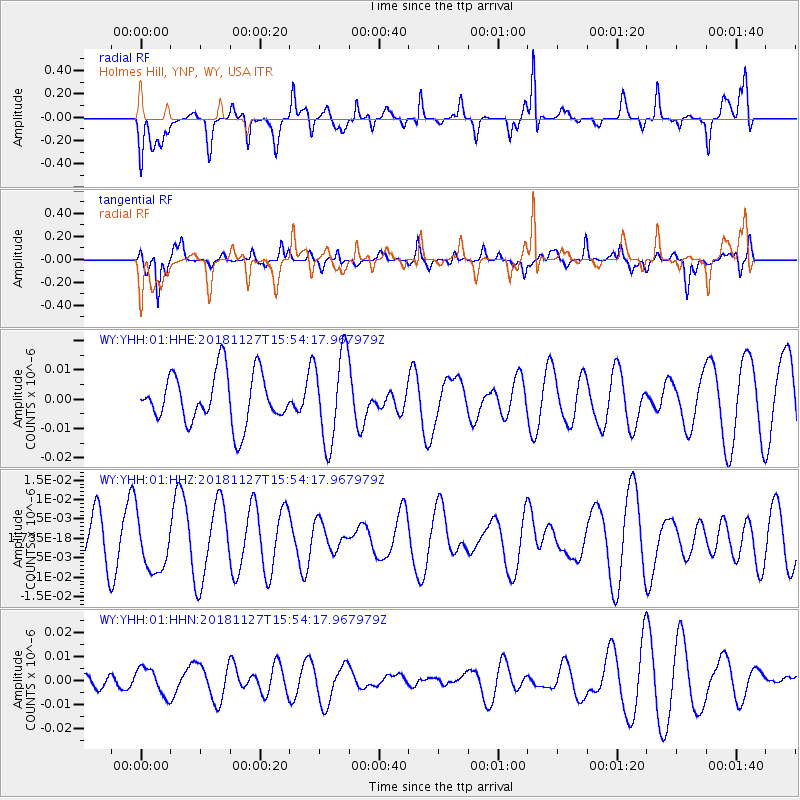
YHH Holmes Hill, YNP, WY, USA - Earthquake Result Viewer
*The percent match for this event was below the threshold and hence no stack was calculated.
| Earthquake location: |
Southeast Of Loyalty Islands |
| Earthquake latitude/longitude: |
-21.3/171.3 |
| Earthquake time(UTC): |
2018/11/27 (331) 15:41:20 GMT |
| Earthquake Depth: |
10 km |
| Earthquake Magnitude: |
5.8 Mww |
| Earthquake Catalog/Contributor: |
NEIC PDE/us |
|
| Network: |
WY Yellowstone Wyoming Seismic Network |
| Station: |
YHH Holmes Hill, YNP, WY, USA |
| Lat/Lon: |
44.79 N/110.85 W |
| Elevation: |
2717 m |
|
| Distance: |
96.5 deg |
| Az: |
44.472 deg |
| Baz: |
246.518 deg |
| Ray Param: |
$rayparam |
*The percent match for this event was below the threshold and hence was not used in the summary stack. |
|
| Radial Match: |
49.994408 % |
| Radial Bump: |
326 |
| Transverse Match: |
60.970425 % |
| Transverse Bump: |
361 |
| SOD ConfigId: |
3165032 |
| Insert Time: |
2018-12-11 15:46:30.957 +0000 |
| GWidth: |
2.5 |
| Max Bumps: |
400 |
| Tol: |
0.001 |
|
Signal To Noise
| Channel | StoN | STA | LTA |
| WY:YHH:01:HHZ:20181127T15:54:17.967979Z | 1.2815722 | 7.0751196E-9 | 5.520656E-9 |
| WY:YHH:01:HHN:20181127T15:54:17.967979Z | 1.6402551 | 5.7258474E-9 | 3.4908274E-9 |
| WY:YHH:01:HHE:20181127T15:54:17.967979Z | 1.7793915 | 1.5203831E-8 | 8.544399E-9 |
| Arrivals |
| Ps | |
| PpPs | |
| PsPs/PpSs | |


