You are here: Home > Network List > TA - USArray Transportable Network (new EarthScope stations) Stations List
> Station L02D Cave Junction, OR, USA > Earthquake Result Viewer
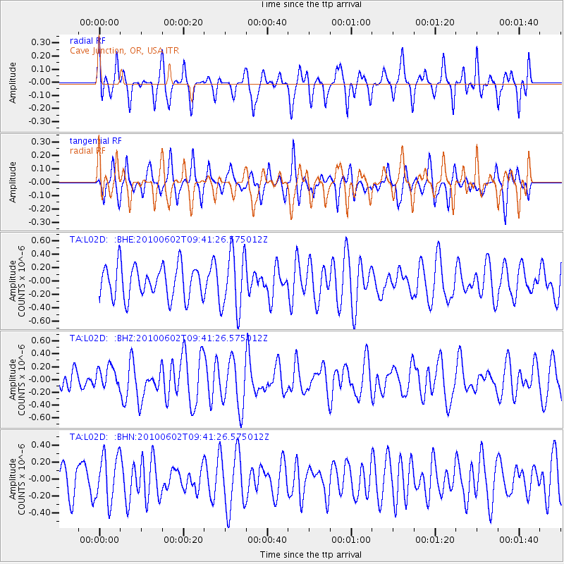
L02D Cave Junction, OR, USA - Earthquake Result Viewer
*The percent match for this event was below the threshold and hence no stack was calculated.
| Earthquake location: |
New Britain Region, P.N.G. |
| Earthquake latitude/longitude: |
-6.2/149.4 |
| Earthquake time(UTC): |
2010/06/02 (153) 09:28:53 GMT |
| Earthquake Depth: |
34 km |
| Earthquake Magnitude: |
5.5 MB, 5.7 MS, 5.9 MW, 5.8 MW |
| Earthquake Catalog/Contributor: |
WHDF/NEIC |
|
| Network: |
TA USArray Transportable Network (new EarthScope stations) |
| Station: |
L02D Cave Junction, OR, USA |
| Lat/Lon: |
42.16 N/123.60 W |
| Elevation: |
458 m |
|
| Distance: |
91.9 deg |
| Az: |
47.979 deg |
| Baz: |
263.437 deg |
| Ray Param: |
$rayparam |
*The percent match for this event was below the threshold and hence was not used in the summary stack. |
|
| Radial Match: |
47.727936 % |
| Radial Bump: |
400 |
| Transverse Match: |
59.38316 % |
| Transverse Bump: |
400 |
| SOD ConfigId: |
317696 |
| Insert Time: |
2010-09-19 07:33:02.425 +0000 |
| GWidth: |
2.5 |
| Max Bumps: |
400 |
| Tol: |
0.001 |
|
Signal To Noise
| Channel | StoN | STA | LTA |
| TA:L02D: :BHZ:20100602T09:41:26.575012Z | 0.9528188 | 1.6643351E-7 | 1.7467488E-7 |
| TA:L02D: :BHN:20100602T09:41:26.575012Z | 1.4045101 | 2.7560984E-7 | 1.96232E-7 |
| TA:L02D: :BHE:20100602T09:41:26.575012Z | 1.8479518 | 4.430768E-7 | 2.3976642E-7 |
| Arrivals |
| Ps | |
| PpPs | |
| PsPs/PpSs | |


