You are here: Home > Network List > GS - US Geological Survey Networks Stations List
> Station OK051 E0350 and S34600 Roads, Ralston, OK > Earthquake Result Viewer
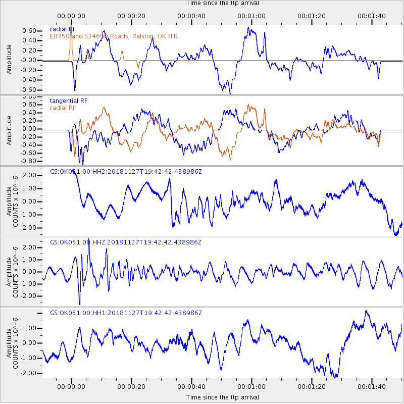
OK051 E0350 and S34600 Roads, Ralston, OK - Earthquake Result Viewer
*The percent match for this event was below the threshold and hence no stack was calculated.
| Earthquake location: |
North Atlantic Ocean |
| Earthquake latitude/longitude: |
15.6/-49.9 |
| Earthquake time(UTC): |
2018/11/27 (331) 19:34:46 GMT |
| Earthquake Depth: |
10 km |
| Earthquake Magnitude: |
5.5 Mww |
| Earthquake Catalog/Contributor: |
NEIC PDE/us |
|
| Network: |
GS US Geological Survey Networks |
| Station: |
OK051 E0350 and S34600 Roads, Ralston, OK |
| Lat/Lon: |
36.51 N/96.84 W |
| Elevation: |
263 m |
|
| Distance: |
46.5 deg |
| Az: |
305.76 deg |
| Baz: |
103.93 deg |
| Ray Param: |
$rayparam |
*The percent match for this event was below the threshold and hence was not used in the summary stack. |
|
| Radial Match: |
43.152405 % |
| Radial Bump: |
400 |
| Transverse Match: |
71.59459 % |
| Transverse Bump: |
400 |
| SOD ConfigId: |
3165032 |
| Insert Time: |
2018-12-11 19:42:24.126 +0000 |
| GWidth: |
2.5 |
| Max Bumps: |
400 |
| Tol: |
0.001 |
|
Signal To Noise
| Channel | StoN | STA | LTA |
| GS:OK051:00:HHZ:20181127T19:42:42.438986Z | 3.5586853 | 1.0212287E-6 | 2.8696797E-7 |
| GS:OK051:00:HH1:20181127T19:42:42.438986Z | 0.8963296 | 9.314717E-7 | 1.0392066E-6 |
| GS:OK051:00:HH2:20181127T19:42:42.438986Z | 1.11341 | 1.0725992E-6 | 9.633461E-7 |
| Arrivals |
| Ps | |
| PpPs | |
| PsPs/PpSs | |


