You are here: Home > Network List > IW - Intermountain West Stations List
> Station DLMT Dillon, Montana, USA > Earthquake Result Viewer
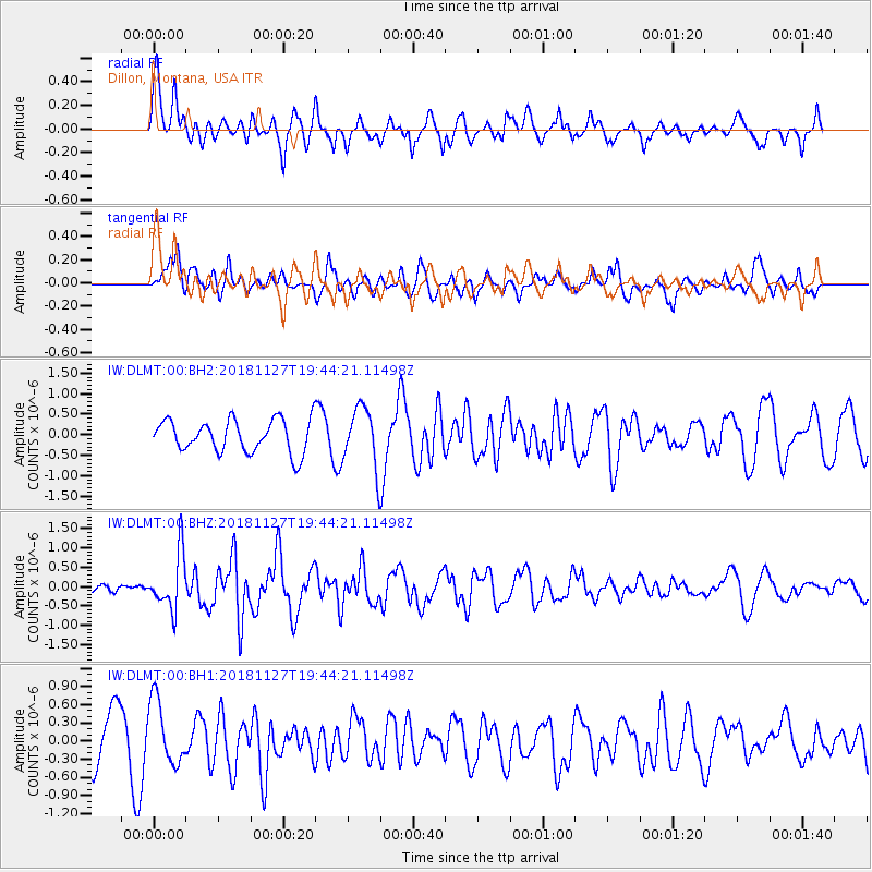
DLMT Dillon, Montana, USA - Earthquake Result Viewer
*The percent match for this event was below the threshold and hence no stack was calculated.
| Earthquake location: |
North Atlantic Ocean |
| Earthquake latitude/longitude: |
15.6/-49.9 |
| Earthquake time(UTC): |
2018/11/27 (331) 19:34:46 GMT |
| Earthquake Depth: |
10 km |
| Earthquake Magnitude: |
5.5 Mww |
| Earthquake Catalog/Contributor: |
NEIC PDE/us |
|
| Network: |
IW Intermountain West |
| Station: |
DLMT Dillon, Montana, USA |
| Lat/Lon: |
45.36 N/112.60 W |
| Elevation: |
1569 m |
|
| Distance: |
59.9 deg |
| Az: |
313.626 deg |
| Baz: |
98.322 deg |
| Ray Param: |
$rayparam |
*The percent match for this event was below the threshold and hence was not used in the summary stack. |
|
| Radial Match: |
50.680557 % |
| Radial Bump: |
400 |
| Transverse Match: |
49.51616 % |
| Transverse Bump: |
400 |
| SOD ConfigId: |
3165032 |
| Insert Time: |
2018-12-11 19:43:07.093 +0000 |
| GWidth: |
2.5 |
| Max Bumps: |
400 |
| Tol: |
0.001 |
|
Signal To Noise
| Channel | StoN | STA | LTA |
| IW:DLMT:00:BHZ:20181127T19:44:21.11498Z | 2.8602095 | 7.275429E-7 | 2.54367E-7 |
| IW:DLMT:00:BH1:20181127T19:44:21.11498Z | 1.7282197 | 5.3247425E-7 | 3.0810563E-7 |
| IW:DLMT:00:BH2:20181127T19:44:21.11498Z | 1.8482866 | 7.288903E-7 | 3.9436E-7 |
| Arrivals |
| Ps | |
| PpPs | |
| PsPs/PpSs | |


