You are here: Home > Network List > IU - Global Seismograph Network (GSN - IRIS/USGS) Stations List
> Station CTAO Charters Towers, Australia > Earthquake Result Viewer
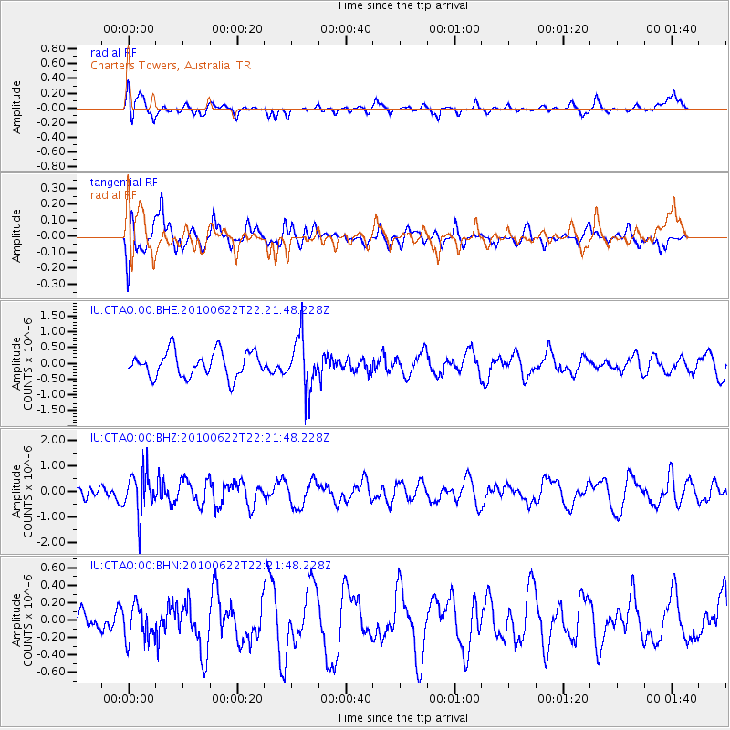
CTAO Charters Towers, Australia - Earthquake Result Viewer
*The percent match for this event was below the threshold and hence no stack was calculated.
| Earthquake location: |
Fiji Islands Region |
| Earthquake latitude/longitude: |
-19.2/-177.6 |
| Earthquake time(UTC): |
2010/06/22 (173) 22:16:20 GMT |
| Earthquake Depth: |
562 km |
| Earthquake Magnitude: |
5.8 MW, 5.1 MB, 5.8 MW |
| Earthquake Catalog/Contributor: |
WHDF/NEIC |
|
| Network: |
IU Global Seismograph Network (GSN - IRIS/USGS) |
| Station: |
CTAO Charters Towers, Australia |
| Lat/Lon: |
20.09 S/146.25 E |
| Elevation: |
357 m |
|
| Distance: |
34.1 deg |
| Az: |
262.335 deg |
| Baz: |
94.8 deg |
| Ray Param: |
$rayparam |
*The percent match for this event was below the threshold and hence was not used in the summary stack. |
|
| Radial Match: |
64.552986 % |
| Radial Bump: |
400 |
| Transverse Match: |
72.86305 % |
| Transverse Bump: |
400 |
| SOD ConfigId: |
318645 |
| Insert Time: |
2010-11-29 18:29:04.770 +0000 |
| GWidth: |
2.5 |
| Max Bumps: |
400 |
| Tol: |
0.001 |
|
Signal To Noise
| Channel | StoN | STA | LTA |
| IU:CTAO:00:BHZ:20100622T22:21:48.228Z | 2.4589407 | 7.9990866E-7 | 3.2530622E-7 |
| IU:CTAO:00:BHN:20100622T22:21:48.228Z | 1.0800012 | 1.9941969E-7 | 1.8464765E-7 |
| IU:CTAO:00:BHE:20100622T22:21:48.228Z | 2.0606964 | 8.1725705E-7 | 3.9659267E-7 |
| Arrivals |
| Ps | |
| PpPs | |
| PsPs/PpSs | |


