You are here: Home > Network List > TA - USArray Transportable Network (new EarthScope stations) Stations List
> Station S36A Lake Cedric, Chanute, KS, USA > Earthquake Result Viewer
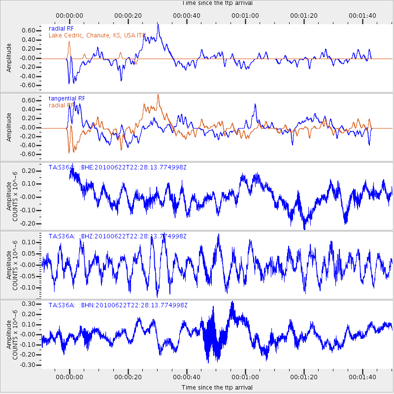
S36A Lake Cedric, Chanute, KS, USA - Earthquake Result Viewer
*The percent match for this event was below the threshold and hence no stack was calculated.
| Earthquake location: |
Fiji Islands Region |
| Earthquake latitude/longitude: |
-19.2/-177.6 |
| Earthquake time(UTC): |
2010/06/22 (173) 22:16:20 GMT |
| Earthquake Depth: |
562 km |
| Earthquake Magnitude: |
5.8 MW, 5.1 MB, 5.8 MW |
| Earthquake Catalog/Contributor: |
WHDF/NEIC |
|
| Network: |
TA USArray Transportable Network (new EarthScope stations) |
| Station: |
S36A Lake Cedric, Chanute, KS, USA |
| Lat/Lon: |
37.72 N/95.59 W |
| Elevation: |
299 m |
|
| Distance: |
95.4 deg |
| Az: |
52.062 deg |
| Baz: |
250.045 deg |
| Ray Param: |
$rayparam |
*The percent match for this event was below the threshold and hence was not used in the summary stack. |
|
| Radial Match: |
36.097275 % |
| Radial Bump: |
400 |
| Transverse Match: |
39.258297 % |
| Transverse Bump: |
400 |
| SOD ConfigId: |
318645 |
| Insert Time: |
2010-11-29 18:45:33.189 +0000 |
| GWidth: |
2.5 |
| Max Bumps: |
400 |
| Tol: |
0.001 |
|
Signal To Noise
| Channel | StoN | STA | LTA |
| TA:S36A: :BHZ:20100622T22:28:13.774998Z | 1.2330848 | 5.387063E-8 | 4.368769E-8 |
| TA:S36A: :BHN:20100622T22:28:13.774998Z | 0.6380437 | 4.6306063E-8 | 7.257506E-8 |
| TA:S36A: :BHE:20100622T22:28:13.774998Z | 0.6692667 | 5.1866934E-8 | 7.749815E-8 |
| Arrivals |
| Ps | |
| PpPs | |
| PsPs/PpSs | |


