You are here: Home > Network List > US - United States National Seismic Network Stations List
> Station AMTX Amarillo, Texas, USA > Earthquake Result Viewer
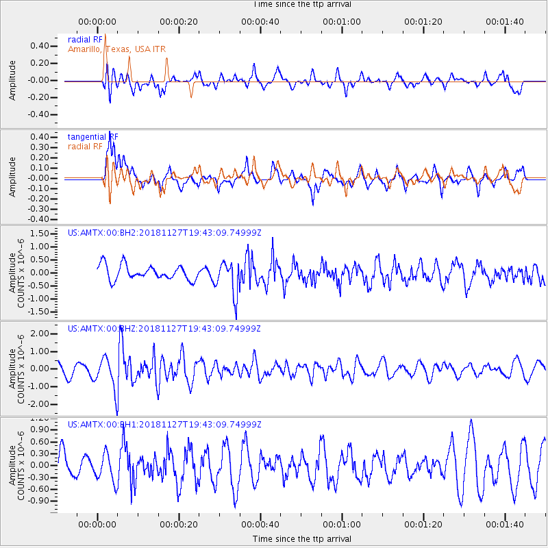
AMTX Amarillo, Texas, USA - Earthquake Result Viewer
*The percent match for this event was below the threshold and hence no stack was calculated.
| Earthquake location: |
North Atlantic Ocean |
| Earthquake latitude/longitude: |
15.6/-49.9 |
| Earthquake time(UTC): |
2018/11/27 (331) 19:34:46 GMT |
| Earthquake Depth: |
10 km |
| Earthquake Magnitude: |
5.5 Mww |
| Earthquake Catalog/Contributor: |
NEIC PDE/us |
|
| Network: |
US United States National Seismic Network |
| Station: |
AMTX Amarillo, Texas, USA |
| Lat/Lon: |
34.53 N/101.41 W |
| Elevation: |
1010 m |
|
| Distance: |
49.8 deg |
| Az: |
302.178 deg |
| Baz: |
98.892 deg |
| Ray Param: |
$rayparam |
*The percent match for this event was below the threshold and hence was not used in the summary stack. |
|
| Radial Match: |
60.316242 % |
| Radial Bump: |
400 |
| Transverse Match: |
61.704815 % |
| Transverse Bump: |
400 |
| SOD ConfigId: |
3165032 |
| Insert Time: |
2018-12-11 19:45:29.862 +0000 |
| GWidth: |
2.5 |
| Max Bumps: |
400 |
| Tol: |
0.001 |
|
Signal To Noise
| Channel | StoN | STA | LTA |
| US:AMTX:00:BHZ:20181127T19:43:09.74999Z | 2.9922292 | 9.349731E-7 | 3.1246708E-7 |
| US:AMTX:00:BH1:20181127T19:43:09.74999Z | 0.7386716 | 3.470023E-7 | 4.697653E-7 |
| US:AMTX:00:BH2:20181127T19:43:09.74999Z | 1.1288192 | 3.0523194E-7 | 2.703993E-7 |
| Arrivals |
| Ps | |
| PpPs | |
| PsPs/PpSs | |


