You are here: Home > Network List > US - United States National Seismic Network Stations List
> Station DGMT Dagmar, Montana, USA > Earthquake Result Viewer
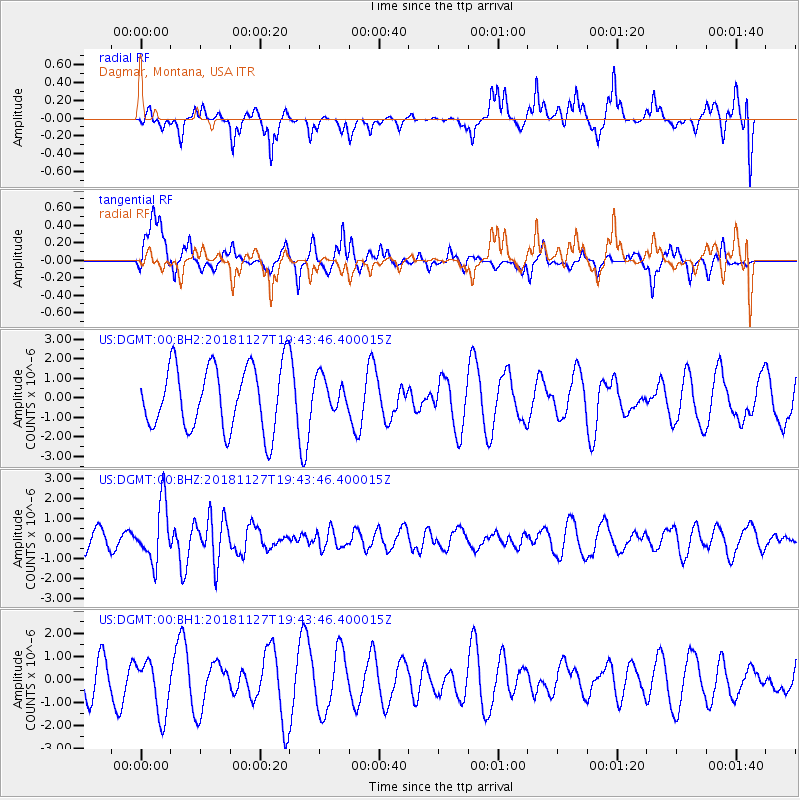
DGMT Dagmar, Montana, USA - Earthquake Result Viewer
*The percent match for this event was below the threshold and hence no stack was calculated.
| Earthquake location: |
North Atlantic Ocean |
| Earthquake latitude/longitude: |
15.6/-49.9 |
| Earthquake time(UTC): |
2018/11/27 (331) 19:34:46 GMT |
| Earthquake Depth: |
10 km |
| Earthquake Magnitude: |
5.5 Mww |
| Earthquake Catalog/Contributor: |
NEIC PDE/us |
|
| Network: |
US United States National Seismic Network |
| Station: |
DGMT Dagmar, Montana, USA |
| Lat/Lon: |
48.47 N/104.20 W |
| Elevation: |
0.0 m |
|
| Distance: |
55.0 deg |
| Az: |
318.721 deg |
| Baz: |
107.19 deg |
| Ray Param: |
$rayparam |
*The percent match for this event was below the threshold and hence was not used in the summary stack. |
|
| Radial Match: |
46.360226 % |
| Radial Bump: |
321 |
| Transverse Match: |
65.78172 % |
| Transverse Bump: |
342 |
| SOD ConfigId: |
3165032 |
| Insert Time: |
2018-12-11 19:45:37.267 +0000 |
| GWidth: |
2.5 |
| Max Bumps: |
400 |
| Tol: |
0.001 |
|
Signal To Noise
| Channel | StoN | STA | LTA |
| US:DGMT:00:BHZ:20181127T19:43:46.400015Z | 2.6282945 | 1.4668993E-6 | 5.5811836E-7 |
| US:DGMT:00:BH1:20181127T19:43:46.400015Z | 1.2277344 | 1.2024711E-6 | 9.794229E-7 |
| US:DGMT:00:BH2:20181127T19:43:46.400015Z | 0.5200756 | 8.4974454E-7 | 1.6338865E-6 |
| Arrivals |
| Ps | |
| PpPs | |
| PsPs/PpSs | |


