You are here: Home > Network List > US - United States National Seismic Network Stations List
> Station LKWY Lake (Yellowstone--Lake), Wyoming, USA > Earthquake Result Viewer
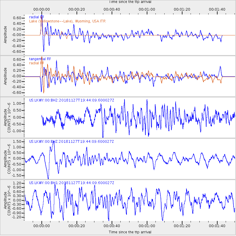
LKWY Lake (Yellowstone--Lake), Wyoming, USA - Earthquake Result Viewer
*The percent match for this event was below the threshold and hence no stack was calculated.
| Earthquake location: |
North Atlantic Ocean |
| Earthquake latitude/longitude: |
15.6/-49.9 |
| Earthquake time(UTC): |
2018/11/27 (331) 19:34:46 GMT |
| Earthquake Depth: |
10 km |
| Earthquake Magnitude: |
5.5 Mww |
| Earthquake Catalog/Contributor: |
NEIC PDE/us |
|
| Network: |
US United States National Seismic Network |
| Station: |
LKWY Lake (Yellowstone--Lake), Wyoming, USA |
| Lat/Lon: |
44.57 N/110.40 W |
| Elevation: |
2424 m |
|
| Distance: |
58.3 deg |
| Az: |
312.991 deg |
| Baz: |
99.543 deg |
| Ray Param: |
$rayparam |
*The percent match for this event was below the threshold and hence was not used in the summary stack. |
|
| Radial Match: |
66.188324 % |
| Radial Bump: |
400 |
| Transverse Match: |
55.404335 % |
| Transverse Bump: |
400 |
| SOD ConfigId: |
3165032 |
| Insert Time: |
2018-12-11 19:46:02.875 +0000 |
| GWidth: |
2.5 |
| Max Bumps: |
400 |
| Tol: |
0.001 |
|
Signal To Noise
| Channel | StoN | STA | LTA |
| US:LKWY:00:BHZ:20181127T19:44:09.600027Z | 2.7862246 | 8.056193E-7 | 2.891437E-7 |
| US:LKWY:00:BH1:20181127T19:44:09.600027Z | 0.9444927 | 5.15635E-7 | 5.4593863E-7 |
| US:LKWY:00:BH2:20181127T19:44:09.600027Z | 2.2381225 | 6.157814E-7 | 2.75133E-7 |
| Arrivals |
| Ps | |
| PpPs | |
| PsPs/PpSs | |


