You are here: Home > Network List > TA - USArray Transportable Network (new EarthScope stations) Stations List
> Station L02D Cave Junction, OR, USA > Earthquake Result Viewer
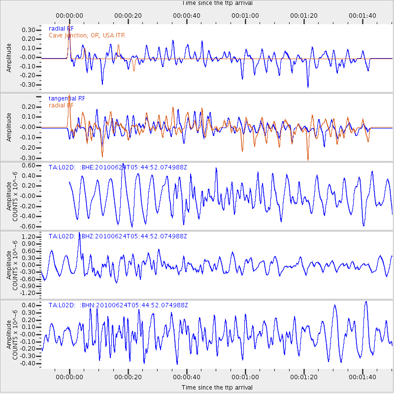
L02D Cave Junction, OR, USA - Earthquake Result Viewer
*The percent match for this event was below the threshold and hence no stack was calculated.
| Earthquake location: |
New Britain Region, P.N.G. |
| Earthquake latitude/longitude: |
-5.5/151.2 |
| Earthquake time(UTC): |
2010/06/24 (175) 05:32:27 GMT |
| Earthquake Depth: |
40 km |
| Earthquake Magnitude: |
5.8 MB, 5.8 MS, 6.1 MW, 6.1 MW |
| Earthquake Catalog/Contributor: |
WHDF/NEIC |
|
| Network: |
TA USArray Transportable Network (new EarthScope stations) |
| Station: |
L02D Cave Junction, OR, USA |
| Lat/Lon: |
42.16 N/123.60 W |
| Elevation: |
458 m |
|
| Distance: |
90.1 deg |
| Az: |
47.814 deg |
| Baz: |
262.747 deg |
| Ray Param: |
$rayparam |
*The percent match for this event was below the threshold and hence was not used in the summary stack. |
|
| Radial Match: |
74.622055 % |
| Radial Bump: |
400 |
| Transverse Match: |
65.04842 % |
| Transverse Bump: |
400 |
| SOD ConfigId: |
318645 |
| Insert Time: |
2010-11-29 19:20:44.373 +0000 |
| GWidth: |
2.5 |
| Max Bumps: |
400 |
| Tol: |
0.001 |
|
Signal To Noise
| Channel | StoN | STA | LTA |
| TA:L02D: :BHZ:20100624T05:44:52.074988Z | 1.488376 | 5.147822E-7 | 3.458684E-7 |
| TA:L02D: :BHN:20100624T05:44:52.074988Z | 0.69096494 | 1.03375434E-7 | 1.4961024E-7 |
| TA:L02D: :BHE:20100624T05:44:52.074988Z | 0.7752288 | 2.37498E-7 | 3.063586E-7 |
| Arrivals |
| Ps | |
| PpPs | |
| PsPs/PpSs | |


