You are here: Home > Network List > UU - University of Utah Regional Network Stations List
> Station CCUT Cedar City, UT, USA > Earthquake Result Viewer
CCUT Cedar City, UT, USA - Earthquake Result Viewer
*The percent match for this event was below the threshold and hence no stack was calculated.
| Earthquake location: |
North Atlantic Ocean |
| Earthquake latitude/longitude: |
15.6/-49.9 |
| Earthquake time(UTC): |
2018/11/27 (331) 19:34:46 GMT |
| Earthquake Depth: |
10 km |
| Earthquake Magnitude: |
5.5 Mww |
| Earthquake Catalog/Contributor: |
NEIC PDE/us |
|
| Network: |
UU University of Utah Regional Network |
| Station: |
CCUT Cedar City, UT, USA |
| Lat/Lon: |
37.55 N/113.36 W |
| Elevation: |
2127 m |
|
| Distance: |
59.7 deg |
| Az: |
304.574 deg |
| Baz: |
93.259 deg |
| Ray Param: |
$rayparam |
*The percent match for this event was below the threshold and hence was not used in the summary stack. |
|
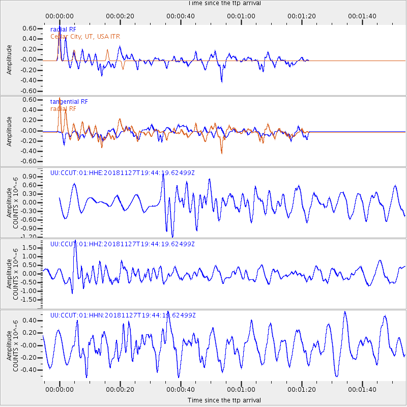
| Radial Match: |
62.378666 % |
| Radial Bump: |
349 |
| Transverse Match: |
51.25935 % |
| Transverse Bump: |
400 |
| SOD ConfigId: |
3165032 |
| Insert Time: |
2018-12-11 19:46:32.321 +0000 |
| GWidth: |
2.5 |
| Max Bumps: |
400 |
| Tol: |
0.001 |
|
Signal To Noise
| Channel | StoN | STA | LTA |
| UU:CCUT:01:HHZ:20181127T19:44:19.62499Z | 3.516596 | 4.616766E-7 | 1.3128509E-7 |
| UU:CCUT:01:HHN:20181127T19:44:19.62499Z | 0.70768905 | 2.121786E-7 | 2.9981896E-7 |
| UU:CCUT:01:HHE:20181127T19:44:19.62499Z | 1.4151142 | 3.4542308E-7 | 2.4409556E-7 |
| Arrivals |
| Ps | |
| PpPs | |
| PsPs/PpSs | |


