You are here: Home > Network List > CN - Canadian National Seismograph Network Stations List
> Station INK INUVIK, NT > Earthquake Result Viewer
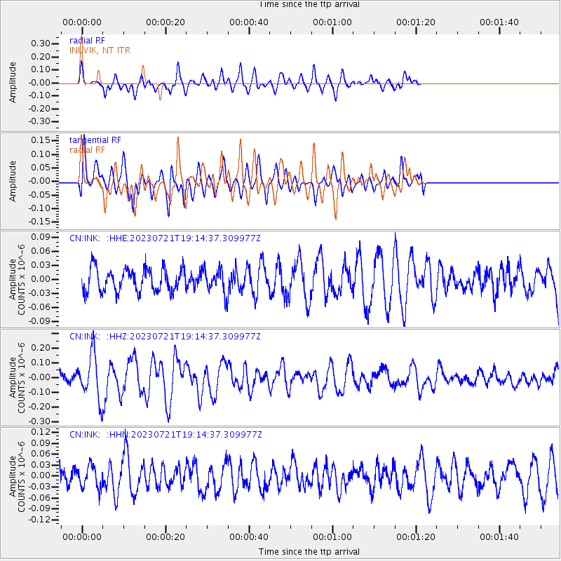
INK INUVIK, NT - Earthquake Result Viewer
*The percent match for this event was below the threshold and hence no stack was calculated.
| Earthquake location: |
Tonga Islands Region |
| Earthquake latitude/longitude: |
-22.6/-175.0 |
| Earthquake time(UTC): |
2023/07/21 (202) 19:01:43 GMT |
| Earthquake Depth: |
11 km |
| Earthquake Magnitude: |
5.5 Mww |
| Earthquake Catalog/Contributor: |
NEIC PDE/us |
|
| Network: |
CN Canadian National Seismograph Network |
| Station: |
INK INUVIK, NT |
| Lat/Lon: |
68.31 N/133.53 W |
| Elevation: |
44 m |
|
| Distance: |
95.6 deg |
| Az: |
14.338 deg |
| Baz: |
217.977 deg |
| Ray Param: |
$rayparam |
*The percent match for this event was below the threshold and hence was not used in the summary stack. |
|
| Radial Match: |
63.567047 % |
| Radial Bump: |
363 |
| Transverse Match: |
61.74086 % |
| Transverse Bump: |
400 |
| SOD ConfigId: |
30536071 |
| Insert Time: |
2023-08-04 19:16:17.424 +0000 |
| GWidth: |
2.5 |
| Max Bumps: |
400 |
| Tol: |
0.001 |
|
Signal To Noise
| Channel | StoN | STA | LTA |
| CN:INK: :HHZ:20230721T19:14:37.309977Z | 3.0402093 | 1.518014E-7 | 4.9931234E-8 |
| CN:INK: :HHN:20230721T19:14:37.309977Z | 1.0086526 | 2.9860647E-8 | 2.960449E-8 |
| CN:INK: :HHE:20230721T19:14:37.309977Z | 1.0432647 | 2.5757002E-8 | 2.4688845E-8 |
| Arrivals |
| Ps | |
| PpPs | |
| PsPs/PpSs | |


