You are here: Home > Network List > UW - Pacific Northwest Regional Seismic Network Stations List
> Station IRON Crane, OR, USA > Earthquake Result Viewer
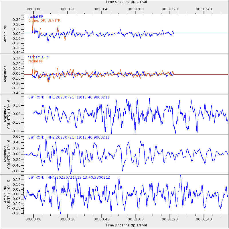
IRON Crane, OR, USA - Earthquake Result Viewer
*The percent match for this event was below the threshold and hence no stack was calculated.
| Earthquake location: |
Tonga Islands Region |
| Earthquake latitude/longitude: |
-22.6/-175.0 |
| Earthquake time(UTC): |
2023/07/21 (202) 19:01:43 GMT |
| Earthquake Depth: |
11 km |
| Earthquake Magnitude: |
5.5 Mww |
| Earthquake Catalog/Contributor: |
NEIC PDE/us |
|
| Network: |
UW Pacific Northwest Regional Seismic Network |
| Station: |
IRON Crane, OR, USA |
| Lat/Lon: |
43.36 N/118.47 W |
| Elevation: |
1226 m |
|
| Distance: |
83.7 deg |
| Az: |
37.761 deg |
| Baz: |
230.863 deg |
| Ray Param: |
$rayparam |
*The percent match for this event was below the threshold and hence was not used in the summary stack. |
|
| Radial Match: |
74.85293 % |
| Radial Bump: |
400 |
| Transverse Match: |
64.55305 % |
| Transverse Bump: |
400 |
| SOD ConfigId: |
30536071 |
| Insert Time: |
2023-08-04 19:29:50.342 +0000 |
| GWidth: |
2.5 |
| Max Bumps: |
400 |
| Tol: |
0.001 |
|
Signal To Noise
| Channel | StoN | STA | LTA |
| UW:IRON: :HHZ:20230721T19:13:40.980021Z | 2.4480376 | 1.2858611E-7 | 5.25262E-8 |
| UW:IRON: :HHN:20230721T19:13:40.980021Z | 1.008542 | 3.13576E-8 | 3.1092014E-8 |
| UW:IRON: :HHE:20230721T19:13:40.980021Z | 0.65387446 | 3.4088764E-8 | 5.21335E-8 |
| Arrivals |
| Ps | |
| PpPs | |
| PsPs/PpSs | |


