You are here: Home > Network List > TA - USArray Transportable Network (new EarthScope stations) Stations List
> Station J04D Umpqua National Forest, Toketee, OR, USA > Earthquake Result Viewer
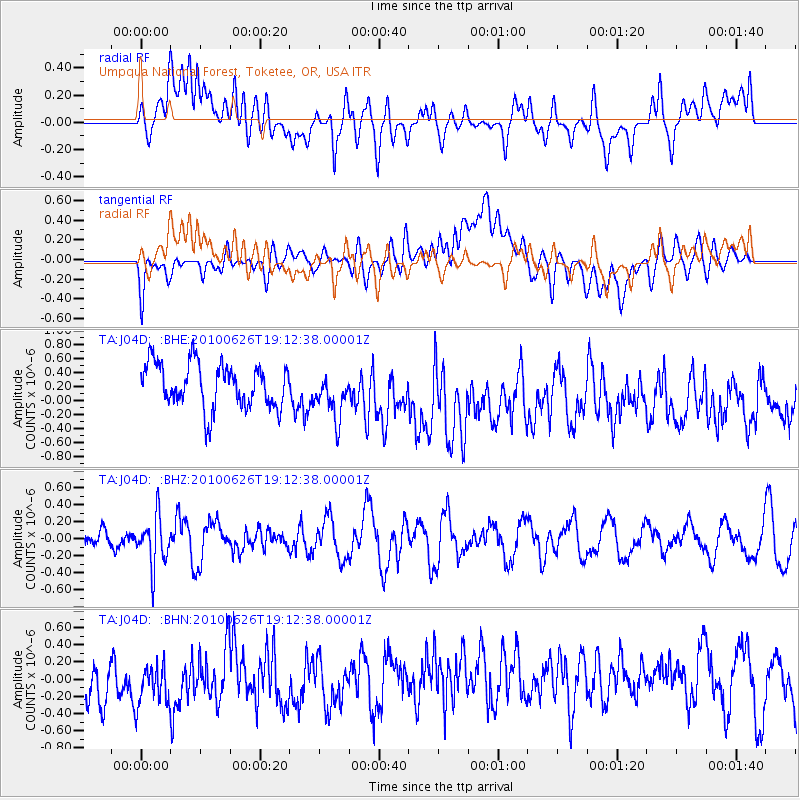
J04D Umpqua National Forest, Toketee, OR, USA - Earthquake Result Viewer
*The percent match for this event was below the threshold and hence no stack was calculated.
| Earthquake location: |
Northern Chile |
| Earthquake latitude/longitude: |
-18.9/-69.2 |
| Earthquake time(UTC): |
2010/06/26 (177) 19:01:18 GMT |
| Earthquake Depth: |
104 km |
| Earthquake Magnitude: |
5.5 MB, 5.4 MW |
| Earthquake Catalog/Contributor: |
WHDF/NEIC |
|
| Network: |
TA USArray Transportable Network (new EarthScope stations) |
| Station: |
J04D Umpqua National Forest, Toketee, OR, USA |
| Lat/Lon: |
43.24 N/122.11 W |
| Elevation: |
1948 m |
|
| Distance: |
78.7 deg |
| Az: |
323.499 deg |
| Baz: |
129.601 deg |
| Ray Param: |
$rayparam |
*The percent match for this event was below the threshold and hence was not used in the summary stack. |
|
| Radial Match: |
42.214928 % |
| Radial Bump: |
400 |
| Transverse Match: |
43.306408 % |
| Transverse Bump: |
400 |
| SOD ConfigId: |
318645 |
| Insert Time: |
2010-11-29 19:36:26.910 +0000 |
| GWidth: |
2.5 |
| Max Bumps: |
400 |
| Tol: |
0.001 |
|
Signal To Noise
| Channel | StoN | STA | LTA |
| TA:J04D: :BHZ:20100626T19:12:38.00001Z | 2.1396115 | 2.8855297E-7 | 1.3486233E-7 |
| TA:J04D: :BHN:20100626T19:12:38.00001Z | 1.0950912 | 3.1076829E-7 | 2.83783E-7 |
| TA:J04D: :BHE:20100626T19:12:38.00001Z | 1.0697268 | 3.334538E-7 | 3.1171868E-7 |
| Arrivals |
| Ps | |
| PpPs | |
| PsPs/PpSs | |


