You are here: Home > Network List > IW - Intermountain West Stations List
> Station MOOW Moose Ponds, Wyoming, USA > Earthquake Result Viewer
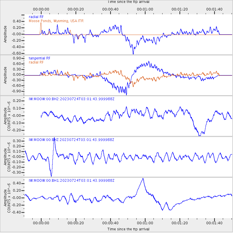
MOOW Moose Ponds, Wyoming, USA - Earthquake Result Viewer
*The percent match for this event was below the threshold and hence no stack was calculated.
| Earthquake location: |
South Of Fiji Islands |
| Earthquake latitude/longitude: |
-24.2/178.8 |
| Earthquake time(UTC): |
2023/07/24 (205) 02:49:58 GMT |
| Earthquake Depth: |
553 km |
| Earthquake Magnitude: |
6.0 mww |
| Earthquake Catalog/Contributor: |
NEIC PDE/us |
|
| Network: |
IW Intermountain West |
| Station: |
MOOW Moose Ponds, Wyoming, USA |
| Lat/Lon: |
43.75 N/110.74 W |
| Elevation: |
2128 m |
|
| Distance: |
93.4 deg |
| Az: |
43.183 deg |
| Baz: |
239.59 deg |
| Ray Param: |
$rayparam |
*The percent match for this event was below the threshold and hence was not used in the summary stack. |
|
| Radial Match: |
29.259863 % |
| Radial Bump: |
400 |
| Transverse Match: |
70.04698 % |
| Transverse Bump: |
400 |
| SOD ConfigId: |
30536071 |
| Insert Time: |
2023-08-07 03:05:33.992 +0000 |
| GWidth: |
2.5 |
| Max Bumps: |
400 |
| Tol: |
0.001 |
|
Signal To Noise
| Channel | StoN | STA | LTA |
| IW:MOOW:00:BHZ:20230724T03:01:43.999988Z | 1.0117342 | 5.335596E-8 | 5.2737136E-8 |
| IW:MOOW:00:BH1:20230724T03:01:43.999988Z | 0.6586553 | 8.4997694E-8 | 1.2904731E-7 |
| IW:MOOW:00:BH2:20230724T03:01:43.999988Z | 0.933559 | 3.899936E-8 | 4.1774925E-8 |
| Arrivals |
| Ps | |
| PpPs | |
| PsPs/PpSs | |


