You are here: Home > Network List > TA - USArray Transportable Network (new EarthScope stations) Stations List
> Station T37A Cheneyville 1850, Columbus, KS, USA > Earthquake Result Viewer
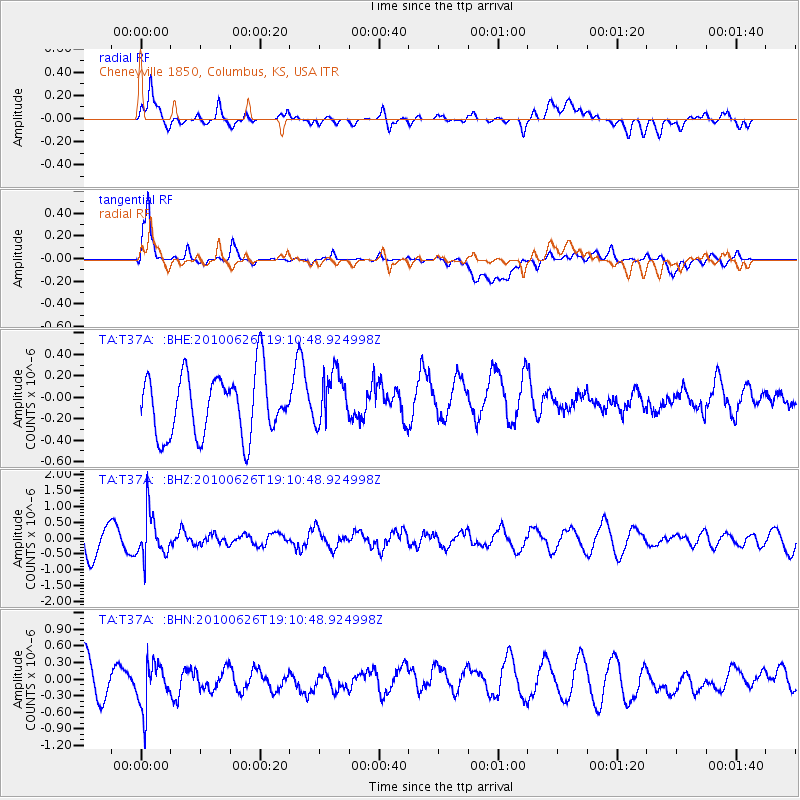
T37A Cheneyville 1850, Columbus, KS, USA - Earthquake Result Viewer
*The percent match for this event was below the threshold and hence no stack was calculated.
| Earthquake location: |
Northern Chile |
| Earthquake latitude/longitude: |
-18.9/-69.2 |
| Earthquake time(UTC): |
2010/06/26 (177) 19:01:18 GMT |
| Earthquake Depth: |
104 km |
| Earthquake Magnitude: |
5.5 MB, 5.4 MW |
| Earthquake Catalog/Contributor: |
WHDF/NEIC |
|
| Network: |
TA USArray Transportable Network (new EarthScope stations) |
| Station: |
T37A Cheneyville 1850, Columbus, KS, USA |
| Lat/Lon: |
37.12 N/94.92 W |
| Elevation: |
256 m |
|
| Distance: |
60.8 deg |
| Az: |
336.559 deg |
| Baz: |
151.893 deg |
| Ray Param: |
$rayparam |
*The percent match for this event was below the threshold and hence was not used in the summary stack. |
|
| Radial Match: |
73.03701 % |
| Radial Bump: |
400 |
| Transverse Match: |
85.1085 % |
| Transverse Bump: |
400 |
| SOD ConfigId: |
318645 |
| Insert Time: |
2010-11-29 19:41:55.089 +0000 |
| GWidth: |
2.5 |
| Max Bumps: |
400 |
| Tol: |
0.001 |
|
Signal To Noise
| Channel | StoN | STA | LTA |
| TA:T37A: :BHZ:20100626T19:10:48.924998Z | 1.5186828 | 6.965418E-7 | 4.5864863E-7 |
| TA:T37A: :BHN:20100626T19:10:48.924998Z | 1.2022991 | 4.1422555E-7 | 3.4452788E-7 |
| TA:T37A: :BHE:20100626T19:10:48.924998Z | 0.8539912 | 2.4528094E-7 | 2.8721718E-7 |
| Arrivals |
| Ps | |
| PpPs | |
| PsPs/PpSs | |


