You are here: Home > Network List > UW - Pacific Northwest Regional Seismic Network Stations List
> Station UMAT Pilot Rock, OR, USA > Earthquake Result Viewer
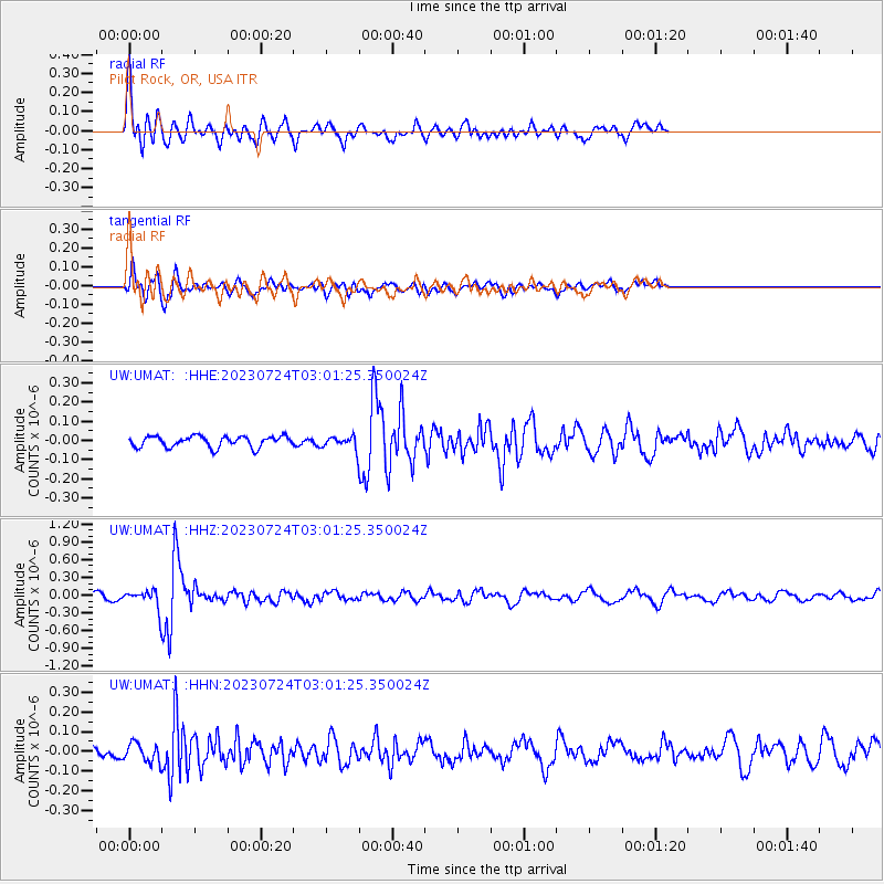
UMAT Pilot Rock, OR, USA - Earthquake Result Viewer
*The percent match for this event was below the threshold and hence no stack was calculated.
| Earthquake location: |
South Of Fiji Islands |
| Earthquake latitude/longitude: |
-24.2/178.8 |
| Earthquake time(UTC): |
2023/07/24 (205) 02:49:58 GMT |
| Earthquake Depth: |
553 km |
| Earthquake Magnitude: |
6.0 mww |
| Earthquake Catalog/Contributor: |
NEIC PDE/us |
|
| Network: |
UW Pacific Northwest Regional Seismic Network |
| Station: |
UMAT Pilot Rock, OR, USA |
| Lat/Lon: |
45.29 N/118.96 W |
| Elevation: |
1318 m |
|
| Distance: |
89.3 deg |
| Az: |
38.677 deg |
| Baz: |
233.953 deg |
| Ray Param: |
$rayparam |
*The percent match for this event was below the threshold and hence was not used in the summary stack. |
|
| Radial Match: |
78.85552 % |
| Radial Bump: |
400 |
| Transverse Match: |
58.34495 % |
| Transverse Bump: |
400 |
| SOD ConfigId: |
30536071 |
| Insert Time: |
2023-08-07 03:13:51.940 +0000 |
| GWidth: |
2.5 |
| Max Bumps: |
400 |
| Tol: |
0.001 |
|
Signal To Noise
| Channel | StoN | STA | LTA |
| UW:UMAT: :HHZ:20230724T03:01:25.350024Z | 3.0579157 | 1.4432887E-7 | 4.7198444E-8 |
| UW:UMAT: :HHN:20230724T03:01:25.350024Z | 1.840033 | 4.6620194E-8 | 2.5336606E-8 |
| UW:UMAT: :HHE:20230724T03:01:25.350024Z | 1.0422164 | 2.983075E-8 | 2.8622413E-8 |
| Arrivals |
| Ps | |
| PpPs | |
| PsPs/PpSs | |


