You are here: Home > Network List > PF - Volcanologic Network of Piton de Fournaise-OVPF Stations List
> Station GPS Grandes Pentes Sud > Earthquake Result Viewer
GPS Grandes Pentes Sud - Earthquake Result Viewer
*The percent match for this event was below the threshold and hence no stack was calculated.
| Earthquake location: |
Northern Sumatra, Indonesia |
| Earthquake latitude/longitude: |
0.3/97.0 |
| Earthquake time(UTC): |
2018/11/29 (333) 20:21:44 GMT |
| Earthquake Depth: |
8.8 km |
| Earthquake Magnitude: |
5.7 Mww |
| Earthquake Catalog/Contributor: |
NEIC PDE/us |
|
| Network: |
PF Volcanologic Network of Piton de Fournaise-OVPF |
| Station: |
GPS Grandes Pentes Sud |
| Lat/Lon: |
21.27 S/55.76 E |
| Elevation: |
1004 m |
|
| Distance: |
45.6 deg |
| Az: |
239.414 deg |
| Baz: |
67.362 deg |
| Ray Param: |
$rayparam |
*The percent match for this event was below the threshold and hence was not used in the summary stack. |
|
| Radial Match: |
60.984554 % |
| Radial Bump: |
400 |
| Transverse Match: |
58.464436 % |
| Transverse Bump: |
400 |
| SOD ConfigId: |
3165032 |
| Insert Time: |
2018-12-13 20:25:10.236 +0000 |
| GWidth: |
2.5 |
| Max Bumps: |
400 |
| Tol: |
0.001 |
|
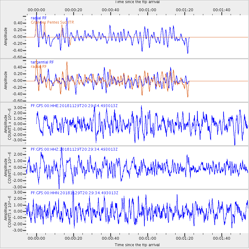
Signal To Noise
| Channel | StoN | STA | LTA |
| PF:GPS:00:HHZ:20181129T20:29:34.493013Z | 2.4845972 | 1.2791281E-6 | 5.148231E-7 |
| PF:GPS:00:HHN:20181129T20:29:34.493013Z | 0.92519635 | 8.3678776E-7 | 9.044434E-7 |
| PF:GPS:00:HHE:20181129T20:29:34.493013Z | 1.6788906 | 1.6615735E-6 | 9.896854E-7 |
| Arrivals |
| Ps | |
| PpPs | |
| PsPs/PpSs | |


