You are here: Home > Network List > TA - USArray Transportable Network (new EarthScope stations) Stations List
> Station U35A Pawnee, OK, USA > Earthquake Result Viewer
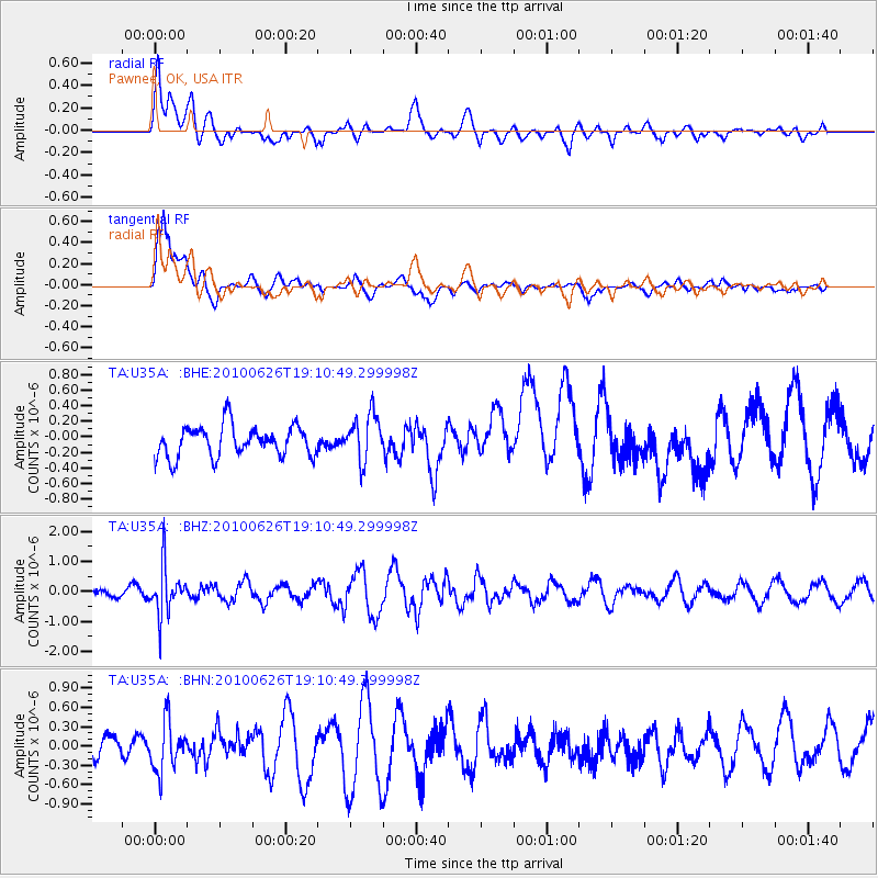
U35A Pawnee, OK, USA - Earthquake Result Viewer
*The percent match for this event was below the threshold and hence no stack was calculated.
| Earthquake location: |
Northern Chile |
| Earthquake latitude/longitude: |
-18.9/-69.2 |
| Earthquake time(UTC): |
2010/06/26 (177) 19:01:18 GMT |
| Earthquake Depth: |
104 km |
| Earthquake Magnitude: |
5.5 MB, 5.4 MW |
| Earthquake Catalog/Contributor: |
WHDF/NEIC |
|
| Network: |
TA USArray Transportable Network (new EarthScope stations) |
| Station: |
U35A Pawnee, OK, USA |
| Lat/Lon: |
36.37 N/96.73 W |
| Elevation: |
303 m |
|
| Distance: |
60.9 deg |
| Az: |
334.683 deg |
| Baz: |
149.898 deg |
| Ray Param: |
$rayparam |
*The percent match for this event was below the threshold and hence was not used in the summary stack. |
|
| Radial Match: |
64.32968 % |
| Radial Bump: |
400 |
| Transverse Match: |
75.10669 % |
| Transverse Bump: |
400 |
| SOD ConfigId: |
318645 |
| Insert Time: |
2010-11-29 19:43:06.089 +0000 |
| GWidth: |
2.5 |
| Max Bumps: |
400 |
| Tol: |
0.001 |
|
Signal To Noise
| Channel | StoN | STA | LTA |
| TA:U35A: :BHZ:20100626T19:10:49.299998Z | 3.9752119 | 7.8747786E-7 | 1.9809708E-7 |
| TA:U35A: :BHN:20100626T19:10:49.299998Z | 2.0497344 | 3.846706E-7 | 1.876685E-7 |
| TA:U35A: :BHE:20100626T19:10:49.299998Z | 1.53521 | 3.0197629E-7 | 1.9670031E-7 |
| Arrivals |
| Ps | |
| PpPs | |
| PsPs/PpSs | |


