You are here: Home > Network List > US - United States National Seismic Network Stations List
> Station EGMT Eagleton, Montana, USA > Earthquake Result Viewer
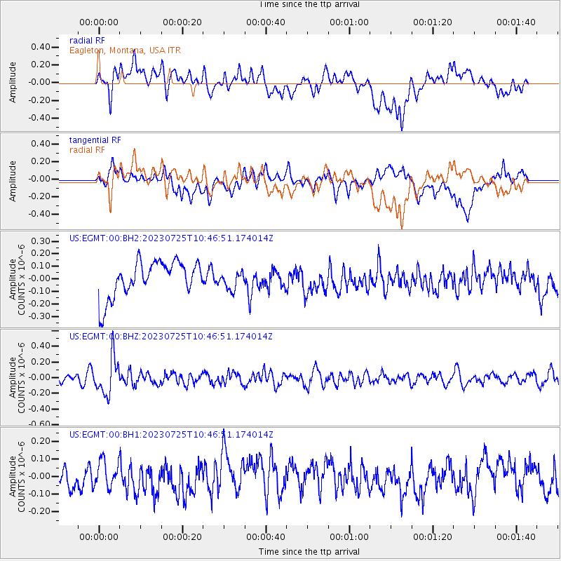
EGMT Eagleton, Montana, USA - Earthquake Result Viewer
*The percent match for this event was below the threshold and hence no stack was calculated.
| Earthquake location: |
Mariana Islands |
| Earthquake latitude/longitude: |
17.1/145.5 |
| Earthquake time(UTC): |
2023/07/25 (206) 10:35:18 GMT |
| Earthquake Depth: |
373 km |
| Earthquake Magnitude: |
5.6 mww |
| Earthquake Catalog/Contributor: |
NEIC PDE/us |
|
| Network: |
US United States National Seismic Network |
| Station: |
EGMT Eagleton, Montana, USA |
| Lat/Lon: |
48.02 N/109.75 W |
| Elevation: |
1055 m |
|
| Distance: |
86.9 deg |
| Az: |
40.552 deg |
| Baz: |
292.183 deg |
| Ray Param: |
$rayparam |
*The percent match for this event was below the threshold and hence was not used in the summary stack. |
|
| Radial Match: |
46.01218 % |
| Radial Bump: |
400 |
| Transverse Match: |
50.233562 % |
| Transverse Bump: |
400 |
| SOD ConfigId: |
30536071 |
| Insert Time: |
2023-08-08 11:01:57.098 +0000 |
| GWidth: |
2.5 |
| Max Bumps: |
400 |
| Tol: |
0.001 |
|
Signal To Noise
| Channel | StoN | STA | LTA |
| US:EGMT:00:BHZ:20230725T10:46:51.174014Z | 6.6020846 | 2.4397676E-7 | 3.6954503E-8 |
| US:EGMT:00:BH1:20230725T10:46:51.174014Z | 1.2073442 | 8.476264E-8 | 7.0205864E-8 |
| US:EGMT:00:BH2:20230725T10:46:51.174014Z | 0.51182055 | 7.338954E-8 | 1.4338922E-7 |
| Arrivals |
| Ps | |
| PpPs | |
| PsPs/PpSs | |


