You are here: Home > Network List > TA - USArray Transportable Network (new EarthScope stations) Stations List
> Station R36A Gordon, Harris, KS, USA > Earthquake Result Viewer
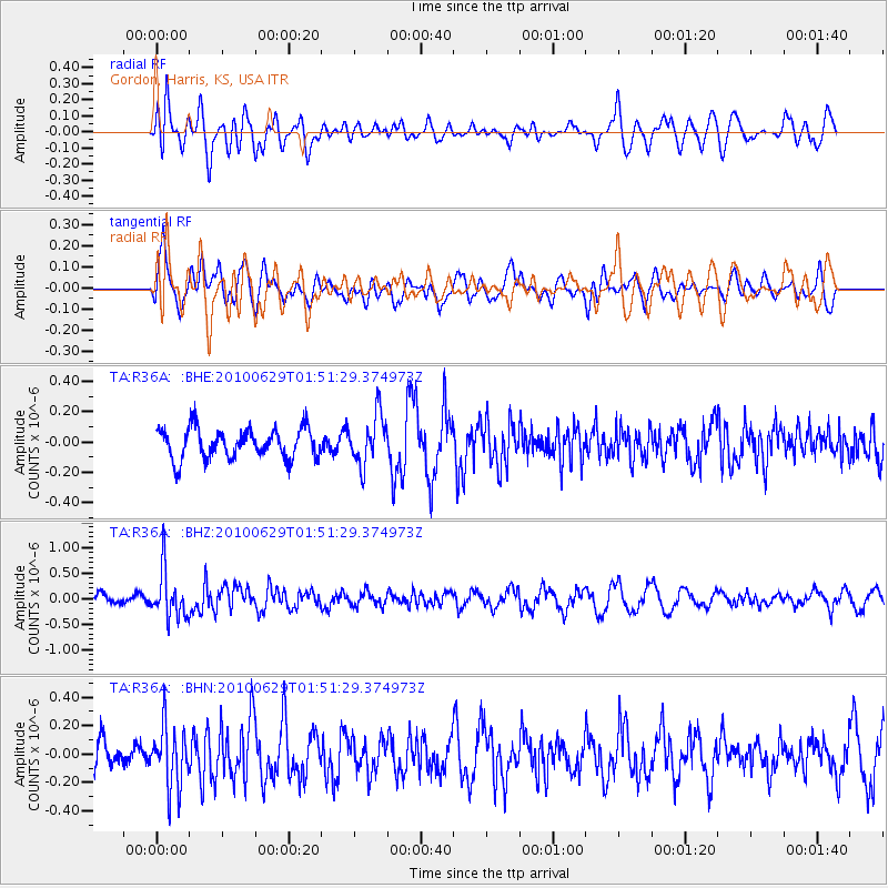
R36A Gordon, Harris, KS, USA - Earthquake Result Viewer
*The percent match for this event was below the threshold and hence no stack was calculated.
| Earthquake location: |
Near Coast Of Central Chile |
| Earthquake latitude/longitude: |
-37.8/-73.3 |
| Earthquake time(UTC): |
2010/06/29 (180) 01:40:00 GMT |
| Earthquake Depth: |
17 km |
| Earthquake Magnitude: |
6.0 MB, 5.2 MS, 5.5 MW, 6.1 ML |
| Earthquake Catalog/Contributor: |
WHDF/NEIC |
|
| Network: |
TA USArray Transportable Network (new EarthScope stations) |
| Station: |
R36A Gordon, Harris, KS, USA |
| Lat/Lon: |
38.32 N/95.50 W |
| Elevation: |
354 m |
|
| Distance: |
78.5 deg |
| Az: |
342.326 deg |
| Baz: |
162.204 deg |
| Ray Param: |
$rayparam |
*The percent match for this event was below the threshold and hence was not used in the summary stack. |
|
| Radial Match: |
65.454666 % |
| Radial Bump: |
400 |
| Transverse Match: |
54.516087 % |
| Transverse Bump: |
400 |
| SOD ConfigId: |
318645 |
| Insert Time: |
2010-11-29 20:10:52.300 +0000 |
| GWidth: |
2.5 |
| Max Bumps: |
400 |
| Tol: |
0.001 |
|
Signal To Noise
| Channel | StoN | STA | LTA |
| TA:R36A: :BHZ:20100629T01:51:29.374973Z | 4.6170206 | 4.6552574E-7 | 1.0082817E-7 |
| TA:R36A: :BHN:20100629T01:51:29.374973Z | 1.8268851 | 2.1668792E-7 | 1.1861059E-7 |
| TA:R36A: :BHE:20100629T01:51:29.374973Z | 1.6720556 | 1.6569602E-7 | 9.909719E-8 |
| Arrivals |
| Ps | |
| PpPs | |
| PsPs/PpSs | |


