You are here: Home > Network List > IU - Global Seismograph Network (GSN - IRIS/USGS) Stations List
> Station CTAO Charters Towers, Australia > Earthquake Result Viewer
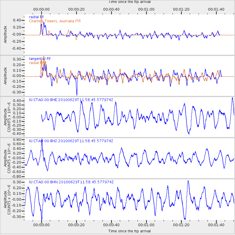
CTAO Charters Towers, Australia - Earthquake Result Viewer
*The percent match for this event was below the threshold and hence no stack was calculated.
| Earthquake location: |
Kuril Islands |
| Earthquake latitude/longitude: |
48.3/154.3 |
| Earthquake time(UTC): |
2010/06/29 (180) 11:48:19 GMT |
| Earthquake Depth: |
43 km |
| Earthquake Magnitude: |
5.5 MB, 4.9 MS, 5.5 MW, 5.3 MW |
| Earthquake Catalog/Contributor: |
WHDF/NEIC |
|
| Network: |
IU Global Seismograph Network (GSN - IRIS/USGS) |
| Station: |
CTAO Charters Towers, Australia |
| Lat/Lon: |
20.09 S/146.25 E |
| Elevation: |
357 m |
|
| Distance: |
68.4 deg |
| Az: |
188.108 deg |
| Baz: |
5.754 deg |
| Ray Param: |
$rayparam |
*The percent match for this event was below the threshold and hence was not used in the summary stack. |
|
| Radial Match: |
68.8226 % |
| Radial Bump: |
400 |
| Transverse Match: |
58.604706 % |
| Transverse Bump: |
400 |
| SOD ConfigId: |
318645 |
| Insert Time: |
2010-11-29 20:21:29.685 +0000 |
| GWidth: |
2.5 |
| Max Bumps: |
400 |
| Tol: |
0.001 |
|
Signal To Noise
| Channel | StoN | STA | LTA |
| IU:CTAO:00:BHZ:20100629T11:58:45.577974Z | 2.1430194 | 3.5636342E-7 | 1.6629033E-7 |
| IU:CTAO:00:BHN:20100629T11:58:45.577974Z | 1.3095592 | 1.254989E-7 | 9.583293E-8 |
| IU:CTAO:00:BHE:20100629T11:58:45.577974Z | 1.4762098 | 2.087637E-7 | 1.4141872E-7 |
| Arrivals |
| Ps | |
| PpPs | |
| PsPs/PpSs | |


