You are here: Home > Network List > TA - USArray Transportable Network (new EarthScope stations) Stations List
> Station O34A Beatrice, NE, USA > Earthquake Result Viewer
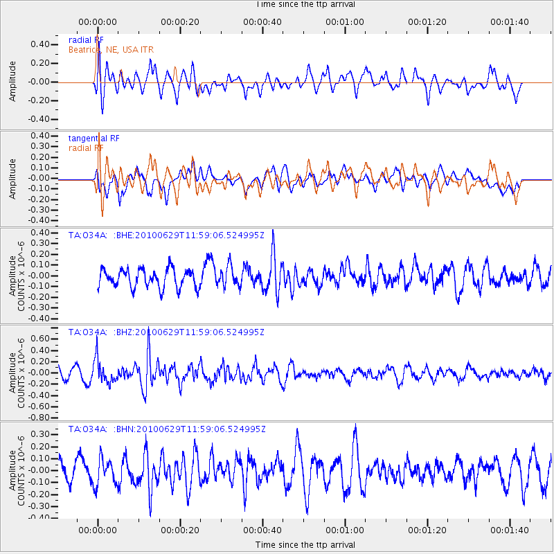
O34A Beatrice, NE, USA - Earthquake Result Viewer
*The percent match for this event was below the threshold and hence no stack was calculated.
| Earthquake location: |
Kuril Islands |
| Earthquake latitude/longitude: |
48.3/154.3 |
| Earthquake time(UTC): |
2010/06/29 (180) 11:48:19 GMT |
| Earthquake Depth: |
43 km |
| Earthquake Magnitude: |
5.5 MB, 4.9 MS, 5.5 MW, 5.3 MW |
| Earthquake Catalog/Contributor: |
WHDF/NEIC |
|
| Network: |
TA USArray Transportable Network (new EarthScope stations) |
| Station: |
O34A Beatrice, NE, USA |
| Lat/Lon: |
40.18 N/96.69 W |
| Elevation: |
409 m |
|
| Distance: |
71.9 deg |
| Az: |
49.652 deg |
| Baz: |
318.349 deg |
| Ray Param: |
$rayparam |
*The percent match for this event was below the threshold and hence was not used in the summary stack. |
|
| Radial Match: |
63.206432 % |
| Radial Bump: |
400 |
| Transverse Match: |
54.655384 % |
| Transverse Bump: |
400 |
| SOD ConfigId: |
318645 |
| Insert Time: |
2010-11-29 20:25:34.788 +0000 |
| GWidth: |
2.5 |
| Max Bumps: |
400 |
| Tol: |
0.001 |
|
Signal To Noise
| Channel | StoN | STA | LTA |
| TA:O34A: :BHZ:20100629T11:59:06.524995Z | 2.6998565 | 2.1331535E-7 | 7.900988E-8 |
| TA:O34A: :BHN:20100629T11:59:06.524995Z | 0.9377824 | 1.10939624E-7 | 1.1829997E-7 |
| TA:O34A: :BHE:20100629T11:59:06.524995Z | 1.0949631 | 9.2309826E-8 | 8.4304055E-8 |
| Arrivals |
| Ps | |
| PpPs | |
| PsPs/PpSs | |


