You are here: Home > Network List > CI - Caltech Regional Seismic Network Stations List
> Station LRL Laurel Mtn Radio Fac, Ridgecrest, CA, USA > Earthquake Result Viewer
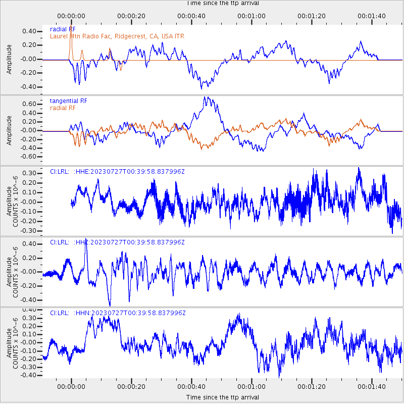
LRL Laurel Mtn Radio Fac, Ridgecrest, CA, USA - Earthquake Result Viewer
*The percent match for this event was below the threshold and hence no stack was calculated.
| Earthquake location: |
Samoa Islands Region |
| Earthquake latitude/longitude: |
-16.3/-172.9 |
| Earthquake time(UTC): |
2023/07/27 (208) 00:28:58 GMT |
| Earthquake Depth: |
10 km |
| Earthquake Magnitude: |
5.5 Mww |
| Earthquake Catalog/Contributor: |
NEIC PDE/us |
|
| Network: |
CI Caltech Regional Seismic Network |
| Station: |
LRL Laurel Mtn Radio Fac, Ridgecrest, CA, USA |
| Lat/Lon: |
35.48 N/117.68 W |
| Elevation: |
1340 m |
|
| Distance: |
73.3 deg |
| Az: |
44.393 deg |
| Baz: |
235.418 deg |
| Ray Param: |
$rayparam |
*The percent match for this event was below the threshold and hence was not used in the summary stack. |
|
| Radial Match: |
54.037903 % |
| Radial Bump: |
400 |
| Transverse Match: |
54.933758 % |
| Transverse Bump: |
400 |
| SOD ConfigId: |
31937991 |
| Insert Time: |
2023-08-10 00:40:41.551 +0000 |
| GWidth: |
2.5 |
| Max Bumps: |
400 |
| Tol: |
0.001 |
|
Signal To Noise
| Channel | StoN | STA | LTA |
| CI:LRL: :HHZ:20230727T00:39:58.837996Z | 2.2725458 | 1.4818686E-7 | 6.5207416E-8 |
| CI:LRL: :HHN:20230727T00:39:58.837996Z | 0.57647943 | 7.2878045E-8 | 1.2641917E-7 |
| CI:LRL: :HHE:20230727T00:39:58.837996Z | 1.2123326 | 1.07243E-7 | 8.846005E-8 |
| Arrivals |
| Ps | |
| PpPs | |
| PsPs/PpSs | |


