You are here: Home > Network List > CN - Canadian National Seismograph Network Stations List
> Station INK INUVIK, NT > Earthquake Result Viewer
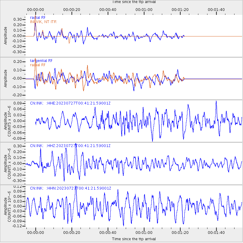
INK INUVIK, NT - Earthquake Result Viewer
*The percent match for this event was below the threshold and hence no stack was calculated.
| Earthquake location: |
Samoa Islands Region |
| Earthquake latitude/longitude: |
-16.3/-172.9 |
| Earthquake time(UTC): |
2023/07/27 (208) 00:28:58 GMT |
| Earthquake Depth: |
10 km |
| Earthquake Magnitude: |
5.5 Mww |
| Earthquake Catalog/Contributor: |
NEIC PDE/us |
|
| Network: |
CN Canadian National Seismograph Network |
| Station: |
INK INUVIK, NT |
| Lat/Lon: |
68.31 N/133.53 W |
| Elevation: |
44 m |
|
| Distance: |
89.0 deg |
| Az: |
13.64 deg |
| Baz: |
217.536 deg |
| Ray Param: |
$rayparam |
*The percent match for this event was below the threshold and hence was not used in the summary stack. |
|
| Radial Match: |
70.68199 % |
| Radial Bump: |
398 |
| Transverse Match: |
64.04834 % |
| Transverse Bump: |
400 |
| SOD ConfigId: |
31937991 |
| Insert Time: |
2023-08-10 00:42:06.527 +0000 |
| GWidth: |
2.5 |
| Max Bumps: |
400 |
| Tol: |
0.001 |
|
Signal To Noise
| Channel | StoN | STA | LTA |
| CN:INK: :HHZ:20230727T00:41:21.59001Z | 1.6342764 | 8.242564E-8 | 5.043556E-8 |
| CN:INK: :HHN:20230727T00:41:21.59001Z | 1.1968288 | 3.6154518E-8 | 3.0208593E-8 |
| CN:INK: :HHE:20230727T00:41:21.59001Z | 1.3370887 | 3.03736E-8 | 2.2716218E-8 |
| Arrivals |
| Ps | |
| PpPs | |
| PsPs/PpSs | |


