You are here: Home > Network List > US - United States National Seismic Network Stations List
> Station HAWA Hanford, Washington, USA > Earthquake Result Viewer
HAWA Hanford, Washington, USA - Earthquake Result Viewer
*The percent match for this event was below the threshold and hence no stack was calculated.
| Earthquake location: |
Samoa Islands Region |
| Earthquake latitude/longitude: |
-16.3/-172.9 |
| Earthquake time(UTC): |
2023/07/27 (208) 00:28:58 GMT |
| Earthquake Depth: |
10 km |
| Earthquake Magnitude: |
5.5 Mww |
| Earthquake Catalog/Contributor: |
NEIC PDE/us |
|
| Network: |
US United States National Seismic Network |
| Station: |
HAWA Hanford, Washington, USA |
| Lat/Lon: |
46.39 N/119.53 W |
| Elevation: |
364 m |
|
| Distance: |
78.7 deg |
| Az: |
34.493 deg |
| Baz: |
231.805 deg |
| Ray Param: |
$rayparam |
*The percent match for this event was below the threshold and hence was not used in the summary stack. |
|
| Radial Match: |
67.486336 % |
| Radial Bump: |
400 |
| Transverse Match: |
52.465755 % |
| Transverse Bump: |
400 |
| SOD ConfigId: |
31937991 |
| Insert Time: |
2023-08-10 00:54:09.129 +0000 |
| GWidth: |
2.5 |
| Max Bumps: |
400 |
| Tol: |
0.001 |
|
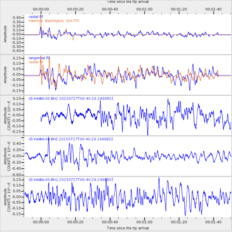
Signal To Noise
| Channel | StoN | STA | LTA |
| US:HAWA:00:BHZ:20230727T00:40:29.249983Z | 2.436457 | 1.8932123E-7 | 7.77035E-8 |
| US:HAWA:00:BH1:20230727T00:40:29.249983Z | 0.9474074 | 4.2079947E-8 | 4.441589E-8 |
| US:HAWA:00:BH2:20230727T00:40:29.249983Z | 1.291237 | 4.1148205E-8 | 3.1867277E-8 |
| Arrivals |
| Ps | |
| PpPs | |
| PsPs/PpSs | |


