You are here: Home > Network List > US - United States National Seismic Network Stations List
> Station MSO Missoula, Montana, USA > Earthquake Result Viewer
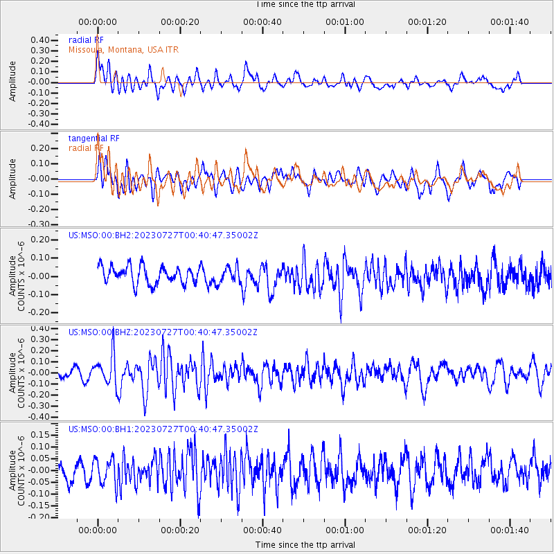
MSO Missoula, Montana, USA - Earthquake Result Viewer
*The percent match for this event was below the threshold and hence no stack was calculated.
| Earthquake location: |
Samoa Islands Region |
| Earthquake latitude/longitude: |
-16.3/-172.9 |
| Earthquake time(UTC): |
2023/07/27 (208) 00:28:58 GMT |
| Earthquake Depth: |
10 km |
| Earthquake Magnitude: |
5.5 Mww |
| Earthquake Catalog/Contributor: |
NEIC PDE/us |
|
| Network: |
US United States National Seismic Network |
| Station: |
MSO Missoula, Montana, USA |
| Lat/Lon: |
46.83 N/113.94 W |
| Elevation: |
1264 m |
|
| Distance: |
82.1 deg |
| Az: |
36.433 deg |
| Baz: |
236.181 deg |
| Ray Param: |
$rayparam |
*The percent match for this event was below the threshold and hence was not used in the summary stack. |
|
| Radial Match: |
60.297855 % |
| Radial Bump: |
400 |
| Transverse Match: |
54.85538 % |
| Transverse Bump: |
400 |
| SOD ConfigId: |
31937991 |
| Insert Time: |
2023-08-10 00:54:19.286 +0000 |
| GWidth: |
2.5 |
| Max Bumps: |
400 |
| Tol: |
0.001 |
|
Signal To Noise
| Channel | StoN | STA | LTA |
| US:MSO:00:BHZ:20230727T00:40:47.35002Z | 3.0257525 | 1.4490018E-7 | 4.7888975E-8 |
| US:MSO:00:BH1:20230727T00:40:47.35002Z | 1.3987042 | 5.6113368E-8 | 4.011811E-8 |
| US:MSO:00:BH2:20230727T00:40:47.35002Z | 0.9196323 | 4.301477E-8 | 4.6773877E-8 |
| Arrivals |
| Ps | |
| PpPs | |
| PsPs/PpSs | |


