You are here: Home > Network List > US - United States National Seismic Network Stations List
> Station WMOK Wichita Mountains, Oklahoma, USA > Earthquake Result Viewer
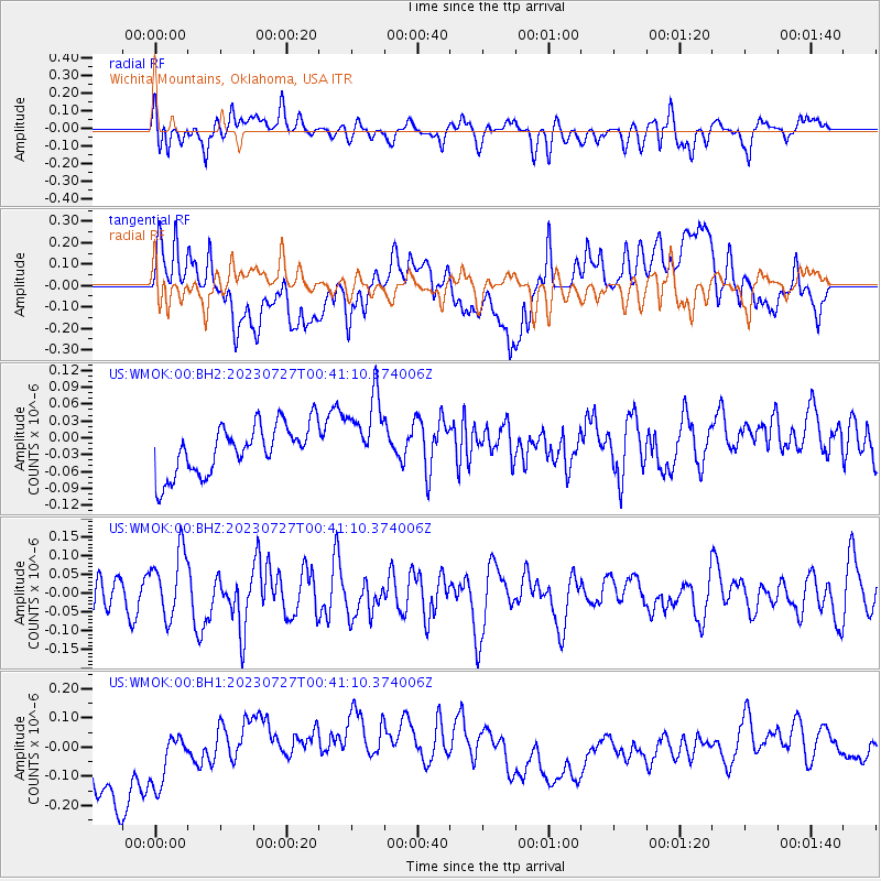
WMOK Wichita Mountains, Oklahoma, USA - Earthquake Result Viewer
*The percent match for this event was below the threshold and hence no stack was calculated.
| Earthquake location: |
Samoa Islands Region |
| Earthquake latitude/longitude: |
-16.3/-172.9 |
| Earthquake time(UTC): |
2023/07/27 (208) 00:28:58 GMT |
| Earthquake Depth: |
10 km |
| Earthquake Magnitude: |
5.5 Mww |
| Earthquake Catalog/Contributor: |
NEIC PDE/us |
|
| Network: |
US United States National Seismic Network |
| Station: |
WMOK Wichita Mountains, Oklahoma, USA |
| Lat/Lon: |
34.74 N/98.78 W |
| Elevation: |
486 m |
|
| Distance: |
86.6 deg |
| Az: |
52.508 deg |
| Baz: |
247.729 deg |
| Ray Param: |
$rayparam |
*The percent match for this event was below the threshold and hence was not used in the summary stack. |
|
| Radial Match: |
45.199898 % |
| Radial Bump: |
400 |
| Transverse Match: |
24.096022 % |
| Transverse Bump: |
400 |
| SOD ConfigId: |
31937991 |
| Insert Time: |
2023-08-10 00:54:27.469 +0000 |
| GWidth: |
2.5 |
| Max Bumps: |
400 |
| Tol: |
0.001 |
|
Signal To Noise
| Channel | StoN | STA | LTA |
| US:WMOK:00:BHZ:20230727T00:41:10.374006Z | 2.674833 | 8.857737E-8 | 3.3115104E-8 |
| US:WMOK:00:BH1:20230727T00:41:10.374006Z | 0.8395791 | 1.0042643E-7 | 1.1961521E-7 |
| US:WMOK:00:BH2:20230727T00:41:10.374006Z | 1.5510666 | 6.7663336E-8 | 4.3623746E-8 |
| Arrivals |
| Ps | |
| PpPs | |
| PsPs/PpSs | |


