You are here: Home > Network List > US - United States National Seismic Network Stations List
> Station WUAZ Wupatki, Arizona, USA > Earthquake Result Viewer
WUAZ Wupatki, Arizona, USA - Earthquake Result Viewer

| Earthquake location: |
Southern Alaska |
| Earthquake latitude/longitude: |
61.3/-149.9 |
| Earthquake time(UTC): |
2018/11/30 (334) 17:29:28 GMT |
| Earthquake Depth: |
43 km |
| Earthquake Magnitude: |
6.6 ml |
| Earthquake Catalog/Contributor: |
NEIC PDE/ak |
|
| Network: |
US United States National Seismic Network |
| Station: |
WUAZ Wupatki, Arizona, USA |
| Lat/Lon: |
35.52 N/111.37 W |
| Elevation: |
1592 m |
|
| Distance: |
35.5 deg |
| Az: |
118.838 deg |
| Baz: |
328.814 deg |
| Ray Param: |
0.07710282 |
| Estimated Moho Depth: |
45.5 km |
| Estimated Crust Vp/Vs: |
2.10 |
| Assumed Crust Vp: |
6.207 km/s |
| Estimated Crust Vs: |
2.959 km/s |
| Estimated Crust Poisson's Ratio: |
0.35 |
|
| Radial Match: |
94.329834 % |
| Radial Bump: |
400 |
| Transverse Match: |
78.19256 % |
| Transverse Bump: |
400 |
| SOD ConfigId: |
3165032 |
| Insert Time: |
2018-12-14 17:44:04.649 +0000 |
| GWidth: |
2.5 |
| Max Bumps: |
400 |
| Tol: |
0.001 |
|
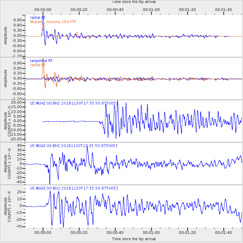
Signal To Noise
| Channel | StoN | STA | LTA |
| US:WUAZ:00:BHZ:20181130T17:35:50.875005Z | 33.677505 | 1.3541535E-5 | 4.0209434E-7 |
| US:WUAZ:00:BH1:20181130T17:35:50.875005Z | 22.479355 | 9.022188E-6 | 4.013544E-7 |
| US:WUAZ:00:BH2:20181130T17:35:50.875005Z | 20.486856 | 5.478514E-6 | 2.6741603E-7 |
| Arrivals |
| Ps | 8.5 SECOND |
| PpPs | 21 SECOND |
| PsPs/PpSs | 30 SECOND |


