You are here: Home > Network List > CI - Caltech Regional Seismic Network Stations List
> Station GLA Glamis, Glamis, CA, USA > Earthquake Result Viewer
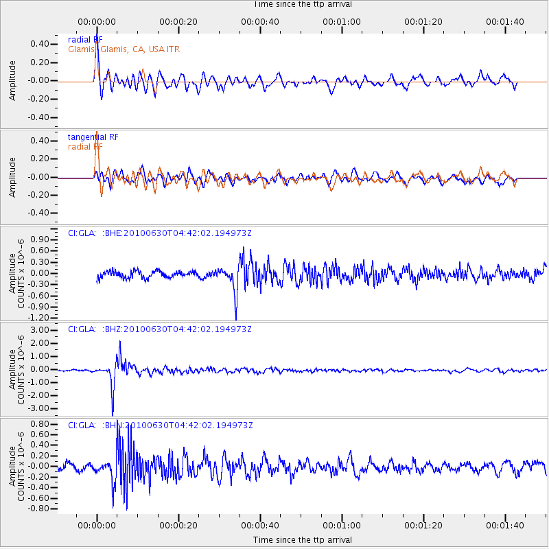
GLA Glamis, Glamis, CA, USA - Earthquake Result Viewer
*The percent match for this event was below the threshold and hence no stack was calculated.
| Earthquake location: |
South Of Fiji Islands |
| Earthquake latitude/longitude: |
-23.3/179.1 |
| Earthquake time(UTC): |
2010/06/30 (181) 04:31:02 GMT |
| Earthquake Depth: |
581 km |
| Earthquake Magnitude: |
5.8 MB, 6.4 MW, 6.3 MW |
| Earthquake Catalog/Contributor: |
WHDF/NEIC |
|
| Network: |
CI Caltech Regional Seismic Network |
| Station: |
GLA Glamis, Glamis, CA, USA |
| Lat/Lon: |
33.05 N/114.83 W |
| Elevation: |
610 m |
|
| Distance: |
84.3 deg |
| Az: |
50.483 deg |
| Baz: |
237.614 deg |
| Ray Param: |
$rayparam |
*The percent match for this event was below the threshold and hence was not used in the summary stack. |
|
| Radial Match: |
79.03817 % |
| Radial Bump: |
400 |
| Transverse Match: |
68.44312 % |
| Transverse Bump: |
400 |
| SOD ConfigId: |
318645 |
| Insert Time: |
2010-11-29 20:34:11.287 +0000 |
| GWidth: |
2.5 |
| Max Bumps: |
400 |
| Tol: |
0.001 |
|
Signal To Noise
| Channel | StoN | STA | LTA |
| CI:GLA: :BHZ:20100630T04:42:02.194973Z | 8.732212 | 9.187662E-7 | 1.05215754E-7 |
| CI:GLA: :BHN:20100630T04:42:02.194973Z | 2.2042944 | 2.1476801E-7 | 9.743164E-8 |
| CI:GLA: :BHE:20100630T04:42:02.194973Z | 4.0634365 | 3.5160676E-7 | 8.652941E-8 |
| Arrivals |
| Ps | |
| PpPs | |
| PsPs/PpSs | |


