You are here: Home > Network List > TA - USArray Transportable Network (new EarthScope stations) Stations List
> Station L02D Cave Junction, OR, USA > Earthquake Result Viewer
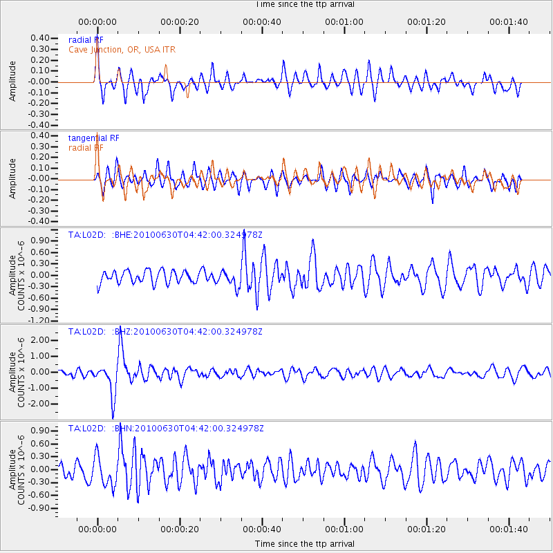
L02D Cave Junction, OR, USA - Earthquake Result Viewer
*The percent match for this event was below the threshold and hence no stack was calculated.
| Earthquake location: |
South Of Fiji Islands |
| Earthquake latitude/longitude: |
-23.3/179.1 |
| Earthquake time(UTC): |
2010/06/30 (181) 04:31:02 GMT |
| Earthquake Depth: |
581 km |
| Earthquake Magnitude: |
5.8 MB, 6.4 MW, 6.3 MW |
| Earthquake Catalog/Contributor: |
WHDF/NEIC |
|
| Network: |
TA USArray Transportable Network (new EarthScope stations) |
| Station: |
L02D Cave Junction, OR, USA |
| Lat/Lon: |
42.16 N/123.60 W |
| Elevation: |
458 m |
|
| Distance: |
83.9 deg |
| Az: |
38.986 deg |
| Baz: |
231.069 deg |
| Ray Param: |
$rayparam |
*The percent match for this event was below the threshold and hence was not used in the summary stack. |
|
| Radial Match: |
73.83813 % |
| Radial Bump: |
400 |
| Transverse Match: |
71.79532 % |
| Transverse Bump: |
400 |
| SOD ConfigId: |
318645 |
| Insert Time: |
2010-11-29 20:38:28.824 +0000 |
| GWidth: |
2.5 |
| Max Bumps: |
400 |
| Tol: |
0.001 |
|
Signal To Noise
| Channel | StoN | STA | LTA |
| TA:L02D: :BHZ:20100630T04:42:00.324978Z | 5.3870854 | 9.92106E-7 | 1.8416378E-7 |
| TA:L02D: :BHN:20100630T04:42:00.324978Z | 1.8425329 | 3.4147112E-7 | 1.8532701E-7 |
| TA:L02D: :BHE:20100630T04:42:00.324978Z | 1.2880822 | 2.0478717E-7 | 1.589861E-7 |
| Arrivals |
| Ps | |
| PpPs | |
| PsPs/PpSs | |


