You are here: Home > Network List > TA - USArray Transportable Network (new EarthScope stations) Stations List
> Station 435B Jarrell, TX, USA > Earthquake Result Viewer
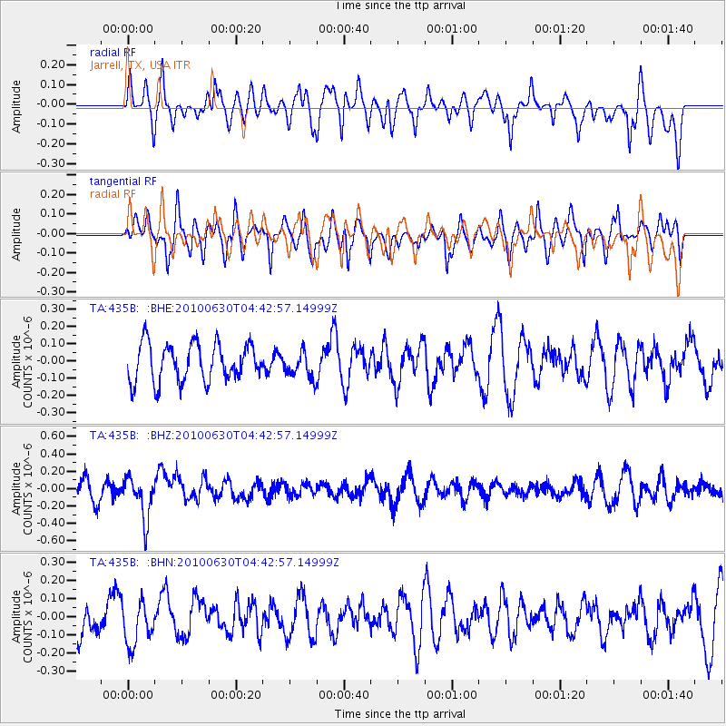
435B Jarrell, TX, USA - Earthquake Result Viewer
*The percent match for this event was below the threshold and hence no stack was calculated.
| Earthquake location: |
South Of Fiji Islands |
| Earthquake latitude/longitude: |
-23.3/179.1 |
| Earthquake time(UTC): |
2010/06/30 (181) 04:31:02 GMT |
| Earthquake Depth: |
581 km |
| Earthquake Magnitude: |
5.8 MB, 6.4 MW, 6.3 MW |
| Earthquake Catalog/Contributor: |
WHDF/NEIC |
|
| Network: |
TA USArray Transportable Network (new EarthScope stations) |
| Station: |
435B Jarrell, TX, USA |
| Lat/Lon: |
30.78 N/97.58 W |
| Elevation: |
248 m |
|
| Distance: |
96.2 deg |
| Az: |
59.291 deg |
| Baz: |
246.701 deg |
| Ray Param: |
$rayparam |
*The percent match for this event was below the threshold and hence was not used in the summary stack. |
|
| Radial Match: |
58.374428 % |
| Radial Bump: |
400 |
| Transverse Match: |
52.5307 % |
| Transverse Bump: |
375 |
| SOD ConfigId: |
318645 |
| Insert Time: |
2010-11-29 20:39:59.102 +0000 |
| GWidth: |
2.5 |
| Max Bumps: |
400 |
| Tol: |
0.001 |
|
Signal To Noise
| Channel | StoN | STA | LTA |
| TA:435B: :BHZ:20100630T04:42:57.14999Z | 2.6023135 | 2.4603438E-7 | 9.4544475E-8 |
| TA:435B: :BHN:20100630T04:42:57.14999Z | 1.3668348 | 1.13431824E-7 | 8.298869E-8 |
| TA:435B: :BHE:20100630T04:42:57.14999Z | 0.70744985 | 7.714282E-8 | 1.0904351E-7 |
| Arrivals |
| Ps | |
| PpPs | |
| PsPs/PpSs | |


