You are here: Home > Network List > GS - US Geological Survey Networks Stations List
> Station OK051 E0350 and S34600 Roads, Ralston, OK > Earthquake Result Viewer
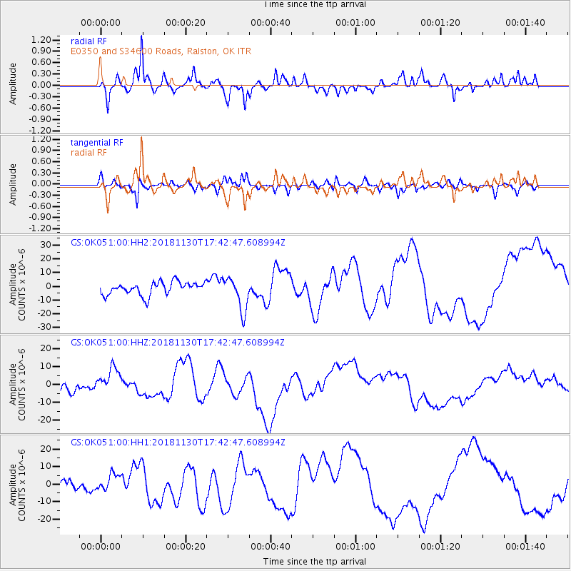
OK051 E0350 and S34600 Roads, Ralston, OK - Earthquake Result Viewer
*The percent match for this event was below the threshold and hence no stack was calculated.
| Earthquake location: |
Southern Alaska |
| Earthquake latitude/longitude: |
61.2/-149.9 |
| Earthquake time(UTC): |
2018/11/30 (334) 17:35:37 GMT |
| Earthquake Depth: |
39 km |
| Earthquake Magnitude: |
5.8 Ml |
| Earthquake Catalog/Contributor: |
NEIC PDE/ak |
|
| Network: |
GS US Geological Survey Networks |
| Station: |
OK051 E0350 and S34600 Roads, Ralston, OK |
| Lat/Lon: |
36.51 N/96.84 W |
| Elevation: |
263 m |
|
| Distance: |
41.2 deg |
| Az: |
101.999 deg |
| Baz: |
323.971 deg |
| Ray Param: |
$rayparam |
*The percent match for this event was below the threshold and hence was not used in the summary stack. |
|
| Radial Match: |
78.311455 % |
| Radial Bump: |
387 |
| Transverse Match: |
79.67996 % |
| Transverse Bump: |
400 |
| SOD ConfigId: |
3165032 |
| Insert Time: |
2018-12-14 17:47:16.953 +0000 |
| GWidth: |
2.5 |
| Max Bumps: |
400 |
| Tol: |
0.001 |
|
Signal To Noise
| Channel | StoN | STA | LTA |
| GS:OK051:00:HHZ:20181130T17:42:47.608994Z | 2.9905818 | 7.684854E-6 | 2.5696852E-6 |
| GS:OK051:00:HH1:20181130T17:42:47.608994Z | 1.6794032 | 5.019008E-6 | 2.9885664E-6 |
| GS:OK051:00:HH2:20181130T17:42:47.608994Z | 2.6503286 | 1.2468759E-5 | 4.7046087E-6 |
| Arrivals |
| Ps | |
| PpPs | |
| PsPs/PpSs | |


