You are here: Home > Network List > CN - Canadian National Seismograph Network Stations List
> Station INK INUVIK, NT, CANADA.ANADA > Earthquake Result Viewer
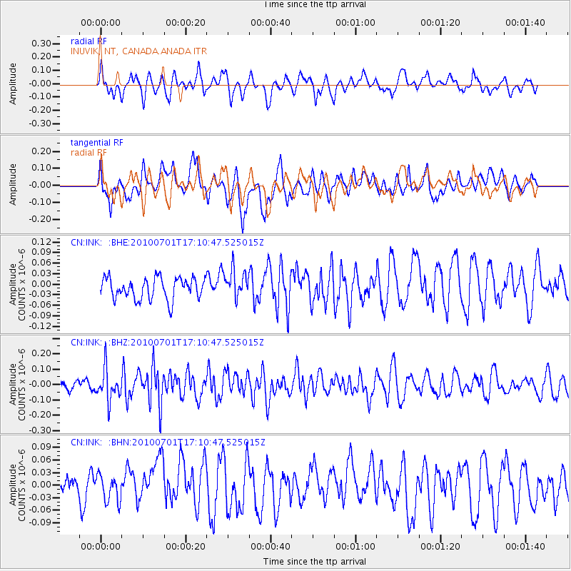
INK INUVIK, NT, CANADA.ANADA - Earthquake Result Viewer
*The percent match for this event was below the threshold and hence no stack was calculated.
| Earthquake location: |
Banda Sea |
| Earthquake latitude/longitude: |
-5.2/129.4 |
| Earthquake time(UTC): |
2010/07/01 (182) 16:57:49 GMT |
| Earthquake Depth: |
36 km |
| Earthquake Magnitude: |
5.7 MB, 5.2 MS, 5.8 MW |
| Earthquake Catalog/Contributor: |
WHDF/NEIC |
|
| Network: |
CN Canadian National Seismograph Network |
| Station: |
INK INUVIK, NT, CANADA.ANADA |
| Lat/Lon: |
68.31 N/133.52 W |
| Elevation: |
40 m |
|
| Distance: |
97.4 deg |
| Az: |
21.842 deg |
| Baz: |
274.68 deg |
| Ray Param: |
$rayparam |
*The percent match for this event was below the threshold and hence was not used in the summary stack. |
|
| Radial Match: |
54.804142 % |
| Radial Bump: |
400 |
| Transverse Match: |
55.547432 % |
| Transverse Bump: |
400 |
| SOD ConfigId: |
319893 |
| Insert Time: |
2011-01-04 22:48:55.415 +0000 |
| GWidth: |
2.5 |
| Max Bumps: |
400 |
| Tol: |
0.001 |
|
Signal To Noise
| Channel | StoN | STA | LTA |
| CN:INK: :BHZ:20100701T17:10:47.525015Z | 3.0605733 | 1.0290748E-7 | 3.3623596E-8 |
| CN:INK: :BHN:20100701T17:10:47.525015Z | 0.8120331 | 3.3903813E-8 | 4.175176E-8 |
| CN:INK: :BHE:20100701T17:10:47.525015Z | 1.3168932 | 3.9738055E-8 | 3.017561E-8 |
| Arrivals |
| Ps | |
| PpPs | |
| PsPs/PpSs | |


