You are here: Home > Network List > US - United States National Seismic Network Stations List
> Station BW06 Boulder Array Site 6 (Pinedale), Wyoming, USA > Earthquake Result Viewer
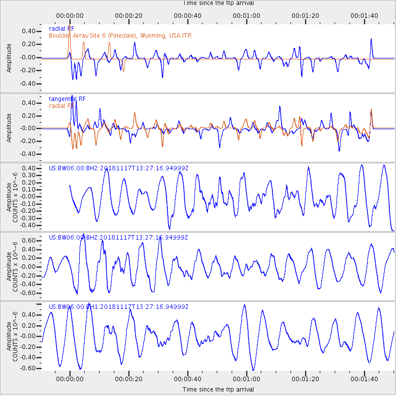
BW06 Boulder Array Site 6 (Pinedale), Wyoming, USA - Earthquake Result Viewer
*The percent match for this event was below the threshold and hence no stack was calculated.
| Earthquake location: |
North Atlantic Ocean |
| Earthquake latitude/longitude: |
15.5/-49.9 |
| Earthquake time(UTC): |
2018/11/17 (321) 13:17:59 GMT |
| Earthquake Depth: |
10 km |
| Earthquake Magnitude: |
5.5 Mww |
| Earthquake Catalog/Contributor: |
NEIC PDE/us |
|
| Network: |
US United States National Seismic Network |
| Station: |
BW06 Boulder Array Site 6 (Pinedale), Wyoming, USA |
| Lat/Lon: |
42.77 N/109.56 W |
| Elevation: |
2224 m |
|
| Distance: |
57.4 deg |
| Az: |
311.034 deg |
| Baz: |
99.114 deg |
| Ray Param: |
$rayparam |
*The percent match for this event was below the threshold and hence was not used in the summary stack. |
|
| Radial Match: |
62.916378 % |
| Radial Bump: |
400 |
| Transverse Match: |
65.29955 % |
| Transverse Bump: |
373 |
| SOD ConfigId: |
3165032 |
| Insert Time: |
2018-12-16 17:41:17.061 +0000 |
| GWidth: |
2.5 |
| Max Bumps: |
400 |
| Tol: |
0.001 |
|
Signal To Noise
| Channel | StoN | STA | LTA |
| US:BW06:00:BHZ:20181117T13:27:16.94999Z | 2.8502998 | 4.4446443E-7 | 1.5593602E-7 |
| US:BW06:00:BH1:20181117T13:27:16.94999Z | 1.7155663 | 4.3328248E-7 | 2.5255946E-7 |
| US:BW06:00:BH2:20181117T13:27:16.94999Z | 1.35217 | 2.430787E-7 | 1.7976933E-7 |
| Arrivals |
| Ps | |
| PpPs | |
| PsPs/PpSs | |


