You are here: Home > Network List > US - United States National Seismic Network Stations List
> Station MNTX Cornudas Mountains, Texas, USA > Earthquake Result Viewer
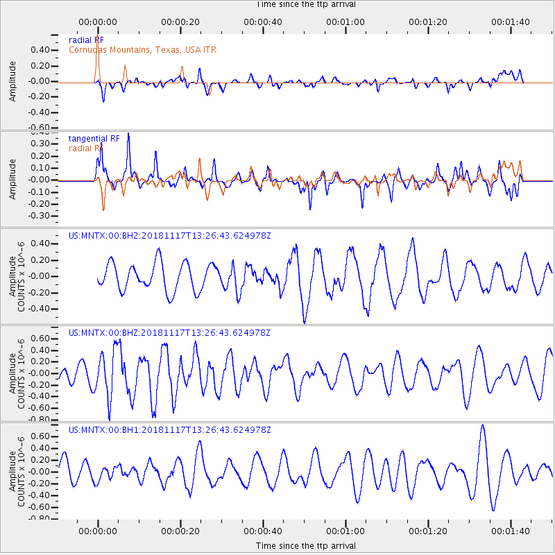
MNTX Cornudas Mountains, Texas, USA - Earthquake Result Viewer
*The percent match for this event was below the threshold and hence no stack was calculated.
| Earthquake location: |
North Atlantic Ocean |
| Earthquake latitude/longitude: |
15.5/-49.9 |
| Earthquake time(UTC): |
2018/11/17 (321) 13:17:59 GMT |
| Earthquake Depth: |
10 km |
| Earthquake Magnitude: |
5.5 Mww |
| Earthquake Catalog/Contributor: |
NEIC PDE/us |
|
| Network: |
US United States National Seismic Network |
| Station: |
MNTX Cornudas Mountains, Texas, USA |
| Lat/Lon: |
31.70 N/105.38 W |
| Elevation: |
404 m |
|
| Distance: |
52.8 deg |
| Az: |
298.127 deg |
| Baz: |
94.229 deg |
| Ray Param: |
$rayparam |
*The percent match for this event was below the threshold and hence was not used in the summary stack. |
|
| Radial Match: |
47.428234 % |
| Radial Bump: |
400 |
| Transverse Match: |
85.03006 % |
| Transverse Bump: |
400 |
| SOD ConfigId: |
3165032 |
| Insert Time: |
2018-12-16 17:41:38.967 +0000 |
| GWidth: |
2.5 |
| Max Bumps: |
400 |
| Tol: |
0.001 |
|
Signal To Noise
| Channel | StoN | STA | LTA |
| US:MNTX:00:BHZ:20181117T13:26:43.624978Z | 2.237128 | 4.0058117E-7 | 1.7906046E-7 |
| US:MNTX:00:BH1:20181117T13:26:43.624978Z | 0.5753911 | 1.312112E-7 | 2.2803827E-7 |
| US:MNTX:00:BH2:20181117T13:26:43.624978Z | 0.8888675 | 1.5036017E-7 | 1.6915925E-7 |
| Arrivals |
| Ps | |
| PpPs | |
| PsPs/PpSs | |


