You are here: Home > Network List > WY - Yellowstone Wyoming Seismic Network Stations List
> Station YHH Holmes Hill, YNP, WY, USA > Earthquake Result Viewer
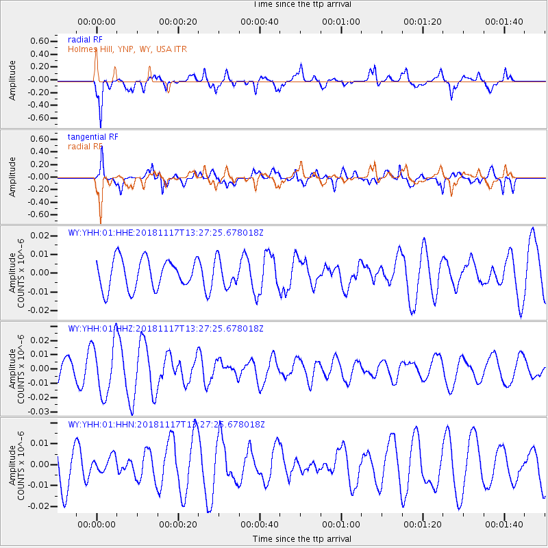
YHH Holmes Hill, YNP, WY, USA - Earthquake Result Viewer
*The percent match for this event was below the threshold and hence no stack was calculated.
| Earthquake location: |
North Atlantic Ocean |
| Earthquake latitude/longitude: |
15.5/-49.9 |
| Earthquake time(UTC): |
2018/11/17 (321) 13:17:59 GMT |
| Earthquake Depth: |
10 km |
| Earthquake Magnitude: |
5.5 Mww |
| Earthquake Catalog/Contributor: |
NEIC PDE/us |
|
| Network: |
WY Yellowstone Wyoming Seismic Network |
| Station: |
YHH Holmes Hill, YNP, WY, USA |
| Lat/Lon: |
44.79 N/110.85 W |
| Elevation: |
2717 m |
|
| Distance: |
58.6 deg |
| Az: |
313.208 deg |
| Baz: |
99.374 deg |
| Ray Param: |
$rayparam |
*The percent match for this event was below the threshold and hence was not used in the summary stack. |
|
| Radial Match: |
73.95635 % |
| Radial Bump: |
400 |
| Transverse Match: |
53.76773 % |
| Transverse Bump: |
400 |
| SOD ConfigId: |
3165032 |
| Insert Time: |
2018-12-16 17:42:22.363 +0000 |
| GWidth: |
2.5 |
| Max Bumps: |
400 |
| Tol: |
0.001 |
|
Signal To Noise
| Channel | StoN | STA | LTA |
| WY:YHH:01:HHZ:20181117T13:27:25.678018Z | 2.2274954 | 1.8396488E-8 | 8.258822E-9 |
| WY:YHH:01:HHN:20181117T13:27:25.678018Z | 0.3302023 | 4.007834E-9 | 1.21375106E-8 |
| WY:YHH:01:HHE:20181117T13:27:25.678018Z | 0.8936284 | 7.0485093E-9 | 7.887517E-9 |
| Arrivals |
| Ps | |
| PpPs | |
| PsPs/PpSs | |


