You are here: Home > Network List > IW - Intermountain West Stations List
> Station MOOW Moose Ponds, Wyoming, USA > Earthquake Result Viewer
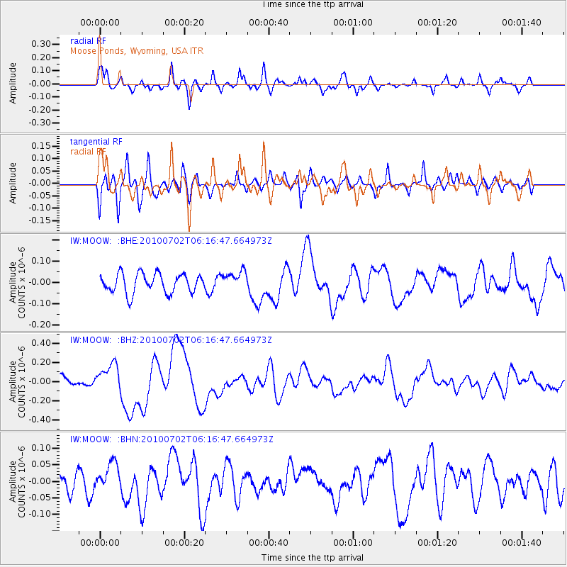
MOOW Moose Ponds, Wyoming, USA - Earthquake Result Viewer
*The percent match for this event was below the threshold and hence no stack was calculated.
| Earthquake location: |
Vanuatu Islands |
| Earthquake latitude/longitude: |
-13.6/166.5 |
| Earthquake time(UTC): |
2010/07/02 (183) 06:04:03 GMT |
| Earthquake Depth: |
29 km |
| Earthquake Magnitude: |
5.8 MB, 6.2 MS, 6.3 MW, 6.3 MW |
| Earthquake Catalog/Contributor: |
WHDF/NEIC |
|
| Network: |
IW Intermountain West |
| Station: |
MOOW Moose Ponds, Wyoming, USA |
| Lat/Lon: |
43.75 N/110.74 W |
| Elevation: |
2128 m |
|
| Distance: |
94.2 deg |
| Az: |
46.125 deg |
| Baz: |
255.236 deg |
| Ray Param: |
$rayparam |
*The percent match for this event was below the threshold and hence was not used in the summary stack. |
|
| Radial Match: |
69.67417 % |
| Radial Bump: |
400 |
| Transverse Match: |
69.262924 % |
| Transverse Bump: |
400 |
| SOD ConfigId: |
319893 |
| Insert Time: |
2011-01-04 23:30:51.190 +0000 |
| GWidth: |
2.5 |
| Max Bumps: |
400 |
| Tol: |
0.001 |
|
Signal To Noise
| Channel | StoN | STA | LTA |
| IW:MOOW: :BHZ:20100702T06:16:47.664973Z | 2.5106637 | 1.4887925E-7 | 5.9298763E-8 |
| IW:MOOW: :BHN:20100702T06:16:47.664973Z | 1.5100219 | 4.284347E-8 | 2.8372748E-8 |
| IW:MOOW: :BHE:20100702T06:16:47.664973Z | 0.9762976 | 4.4556984E-8 | 4.5638732E-8 |
| Arrivals |
| Ps | |
| PpPs | |
| PsPs/PpSs | |


