You are here: Home > Network List > TA - USArray Transportable Network (new EarthScope stations) Stations List
> Station Q24A Divide, CO, USA > Earthquake Result Viewer
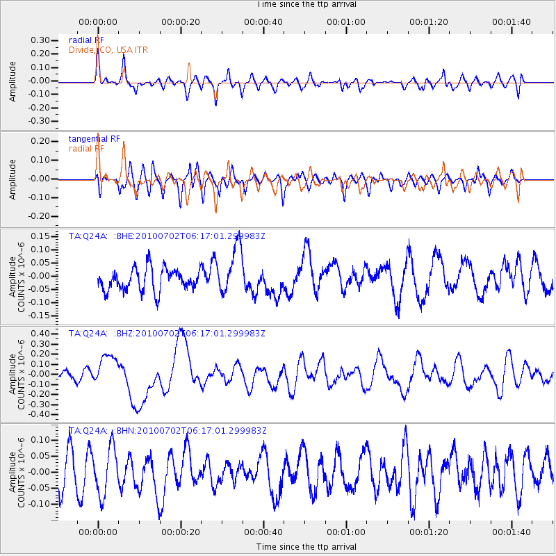
Q24A Divide, CO, USA - Earthquake Result Viewer
*The percent match for this event was below the threshold and hence no stack was calculated.
| Earthquake location: |
Vanuatu Islands |
| Earthquake latitude/longitude: |
-13.6/166.5 |
| Earthquake time(UTC): |
2010/07/02 (183) 06:04:03 GMT |
| Earthquake Depth: |
29 km |
| Earthquake Magnitude: |
5.8 MB, 6.2 MS, 6.3 MW, 6.3 MW |
| Earthquake Catalog/Contributor: |
WHDF/NEIC |
|
| Network: |
TA USArray Transportable Network (new EarthScope stations) |
| Station: |
Q24A Divide, CO, USA |
| Lat/Lon: |
38.96 N/105.15 W |
| Elevation: |
2775 m |
|
| Distance: |
97.2 deg |
| Az: |
51.763 deg |
| Baz: |
258.365 deg |
| Ray Param: |
$rayparam |
*The percent match for this event was below the threshold and hence was not used in the summary stack. |
|
| Radial Match: |
63.319344 % |
| Radial Bump: |
400 |
| Transverse Match: |
49.487232 % |
| Transverse Bump: |
400 |
| SOD ConfigId: |
319893 |
| Insert Time: |
2011-01-04 23:33:48.027 +0000 |
| GWidth: |
2.5 |
| Max Bumps: |
400 |
| Tol: |
0.001 |
|
Signal To Noise
| Channel | StoN | STA | LTA |
| TA:Q24A: :BHZ:20100702T06:17:01.299983Z | 3.3494325 | 1.604506E-7 | 4.7903814E-8 |
| TA:Q24A: :BHN:20100702T06:17:01.299983Z | 1.3583498 | 7.430089E-8 | 5.469938E-8 |
| TA:Q24A: :BHE:20100702T06:17:01.299983Z | 2.2647123 | 9.440662E-8 | 4.1685922E-8 |
| Arrivals |
| Ps | |
| PpPs | |
| PsPs/PpSs | |


