You are here: Home > Network List > AV - Alaska Volcano Observatory Stations List
> Station MAPS Pakushin Southeast, Makushin Volcano, Alaska > Earthquake Result Viewer
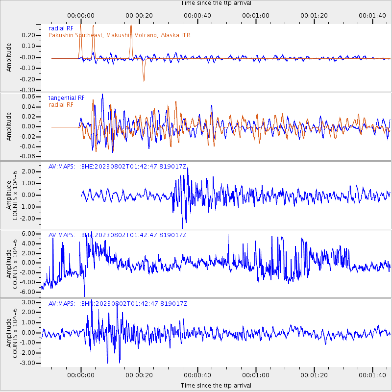
MAPS Pakushin Southeast, Makushin Volcano, Alaska - Earthquake Result Viewer
*The percent match for this event was below the threshold and hence no stack was calculated.
| Earthquake location: |
Fiji Islands Region |
| Earthquake latitude/longitude: |
-21.6/-179.3 |
| Earthquake time(UTC): |
2023/08/02 (214) 01:32:35 GMT |
| Earthquake Depth: |
632 km |
| Earthquake Magnitude: |
5.8 mww |
| Earthquake Catalog/Contributor: |
NEIC PDE/us |
|
| Network: |
AV Alaska Volcano Observatory |
| Station: |
MAPS Pakushin Southeast, Makushin Volcano, Alaska |
| Lat/Lon: |
53.81 N/166.94 W |
| Elevation: |
333 m |
|
| Distance: |
75.8 deg |
| Az: |
7.497 deg |
| Baz: |
191.814 deg |
| Ray Param: |
$rayparam |
*The percent match for this event was below the threshold and hence was not used in the summary stack. |
|
| Radial Match: |
54.240562 % |
| Radial Bump: |
400 |
| Transverse Match: |
45.32848 % |
| Transverse Bump: |
400 |
| SOD ConfigId: |
31937991 |
| Insert Time: |
2023-08-16 01:41:45.068 +0000 |
| GWidth: |
2.5 |
| Max Bumps: |
400 |
| Tol: |
0.001 |
|
Signal To Noise
| Channel | StoN | STA | LTA |
| AV:MAPS: :BHZ:20230802T01:42:47.819017Z | 0.92234486 | 3.0787019E-6 | 3.3379076E-6 |
| AV:MAPS: :BHN:20230802T01:42:47.819017Z | 3.9010434 | 9.830779E-7 | 2.5200384E-7 |
| AV:MAPS: :BHE:20230802T01:42:47.819017Z | 3.1580856 | 8.616439E-7 | 2.728374E-7 |
| Arrivals |
| Ps | |
| PpPs | |
| PsPs/PpSs | |


