You are here: Home > Network List > UW - Pacific Northwest Regional Seismic Network Stations List
> Station FISH Seaside, OR, USA > Earthquake Result Viewer
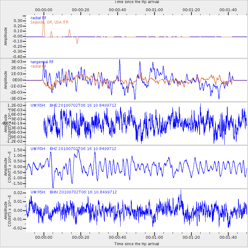
FISH Seaside, OR, USA - Earthquake Result Viewer
*The percent match for this event was below the threshold and hence no stack was calculated.
| Earthquake location: |
Vanuatu Islands |
| Earthquake latitude/longitude: |
-13.6/166.5 |
| Earthquake time(UTC): |
2010/07/02 (183) 06:04:03 GMT |
| Earthquake Depth: |
29 km |
| Earthquake Magnitude: |
5.8 MB, 6.2 MS, 6.3 MW, 6.3 MW |
| Earthquake Catalog/Contributor: |
WHDF/NEIC |
|
| Network: |
UW Pacific Northwest Regional Seismic Network |
| Station: |
FISH Seaside, OR, USA |
| Lat/Lon: |
45.93 N/123.56 W |
| Elevation: |
325 m |
|
| Distance: |
86.3 deg |
| Az: |
41.074 deg |
| Baz: |
246.231 deg |
| Ray Param: |
$rayparam |
*The percent match for this event was below the threshold and hence was not used in the summary stack. |
|
| Radial Match: |
57.514744 % |
| Radial Bump: |
400 |
| Transverse Match: |
53.46292 % |
| Transverse Bump: |
400 |
| SOD ConfigId: |
319893 |
| Insert Time: |
2011-01-04 23:40:43.004 +0000 |
| GWidth: |
2.5 |
| Max Bumps: |
400 |
| Tol: |
0.001 |
|
Signal To Noise
| Channel | StoN | STA | LTA |
| UW:FISH: :BHZ:20100702T06:16:10.849971Z | 2.5245304 | 6.8407064E-7 | 2.7096945E-7 |
| UW:FISH: :BHN:20100702T06:16:10.849971Z | 0.89395136 | 5.502745E-9 | 6.1555308E-9 |
| UW:FISH: :BHE:20100702T06:16:10.849971Z | 0.8494119 | 3.9052543E-9 | 4.597598E-9 |
| Arrivals |
| Ps | |
| PpPs | |
| PsPs/PpSs | |


