You are here: Home > Network List > IW - Intermountain West Stations List
> Station MOOW Moose Ponds, Wyoming, USA > Earthquake Result Viewer
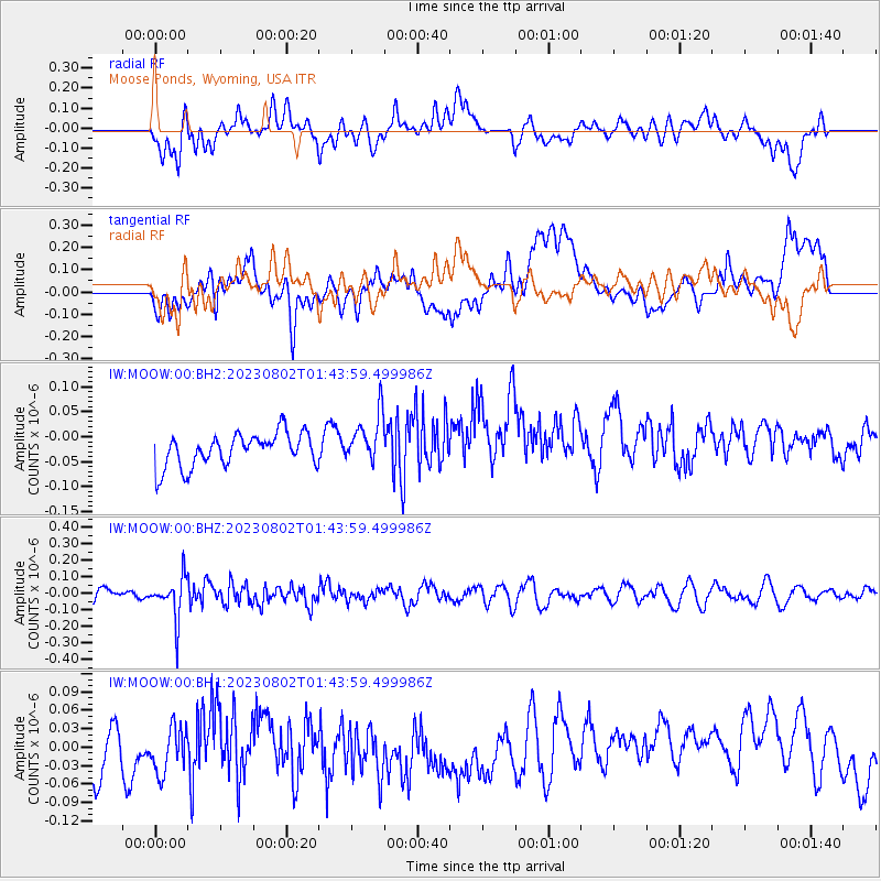
MOOW Moose Ponds, Wyoming, USA - Earthquake Result Viewer
*The percent match for this event was below the threshold and hence no stack was calculated.
| Earthquake location: |
Fiji Islands Region |
| Earthquake latitude/longitude: |
-21.6/-179.3 |
| Earthquake time(UTC): |
2023/08/02 (214) 01:32:35 GMT |
| Earthquake Depth: |
632 km |
| Earthquake Magnitude: |
5.8 mww |
| Earthquake Catalog/Contributor: |
NEIC PDE/us |
|
| Network: |
IW Intermountain West |
| Station: |
MOOW Moose Ponds, Wyoming, USA |
| Lat/Lon: |
43.75 N/110.74 W |
| Elevation: |
2128 m |
|
| Distance: |
90.3 deg |
| Az: |
42.403 deg |
| Baz: |
239.992 deg |
| Ray Param: |
$rayparam |
*The percent match for this event was below the threshold and hence was not used in the summary stack. |
|
| Radial Match: |
43.824883 % |
| Radial Bump: |
400 |
| Transverse Match: |
30.019018 % |
| Transverse Bump: |
400 |
| SOD ConfigId: |
31937991 |
| Insert Time: |
2023-08-16 01:52:19.712 +0000 |
| GWidth: |
2.5 |
| Max Bumps: |
400 |
| Tol: |
0.001 |
|
Signal To Noise
| Channel | StoN | STA | LTA |
| IW:MOOW:00:BHZ:20230802T01:43:59.499986Z | 2.9638412 | 1.2491601E-7 | 4.214666E-8 |
| IW:MOOW:00:BH1:20230802T01:43:59.499986Z | 0.7578222 | 6.381171E-8 | 8.420407E-8 |
| IW:MOOW:00:BH2:20230802T01:43:59.499986Z | 1.4978987 | 4.9735462E-8 | 3.3203488E-8 |
| Arrivals |
| Ps | |
| PpPs | |
| PsPs/PpSs | |


