You are here: Home > Network List > TA - USArray Transportable Network (new EarthScope stations) Stations List
> Station 529A Stev Forest Ranch, Sanderson, TX, USA > Earthquake Result Viewer
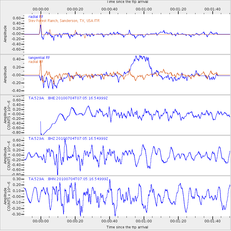
529A Stev Forest Ranch, Sanderson, TX, USA - Earthquake Result Viewer
*The percent match for this event was below the threshold and hence no stack was calculated.
| Earthquake location: |
Off Coast Of Northern Peru |
| Earthquake latitude/longitude: |
-8.5/-80.5 |
| Earthquake time(UTC): |
2010/07/04 (185) 06:57:44 GMT |
| Earthquake Depth: |
29 km |
| Earthquake Magnitude: |
5.7 MW, 5.3 MB, 5.6 MW |
| Earthquake Catalog/Contributor: |
WHDF/NEIC |
|
| Network: |
TA USArray Transportable Network (new EarthScope stations) |
| Station: |
529A Stev Forest Ranch, Sanderson, TX, USA |
| Lat/Lon: |
30.12 N/102.22 W |
| Elevation: |
764 m |
|
| Distance: |
43.7 deg |
| Az: |
332.309 deg |
| Baz: |
147.955 deg |
| Ray Param: |
$rayparam |
*The percent match for this event was below the threshold and hence was not used in the summary stack. |
|
| Radial Match: |
61.075363 % |
| Radial Bump: |
400 |
| Transverse Match: |
30.586618 % |
| Transverse Bump: |
400 |
| SOD ConfigId: |
319893 |
| Insert Time: |
2011-01-04 23:46:10.462 +0000 |
| GWidth: |
2.5 |
| Max Bumps: |
400 |
| Tol: |
0.001 |
|
Signal To Noise
| Channel | StoN | STA | LTA |
| TA:529A: :BHZ:20100704T07:05:16.54999Z | 1.3753889 | 1.5831016E-7 | 1.1510211E-7 |
| TA:529A: :BHN:20100704T07:05:16.54999Z | 1.3279711 | 2.2429658E-7 | 1.689017E-7 |
| TA:529A: :BHE:20100704T07:05:16.54999Z | 0.8881652 | 2.9947998E-7 | 3.371895E-7 |
| Arrivals |
| Ps | |
| PpPs | |
| PsPs/PpSs | |


