You are here: Home > Network List > TA - USArray Transportable Network (new EarthScope stations) Stations List
> Station 933A Laredo, TX, USA > Earthquake Result Viewer
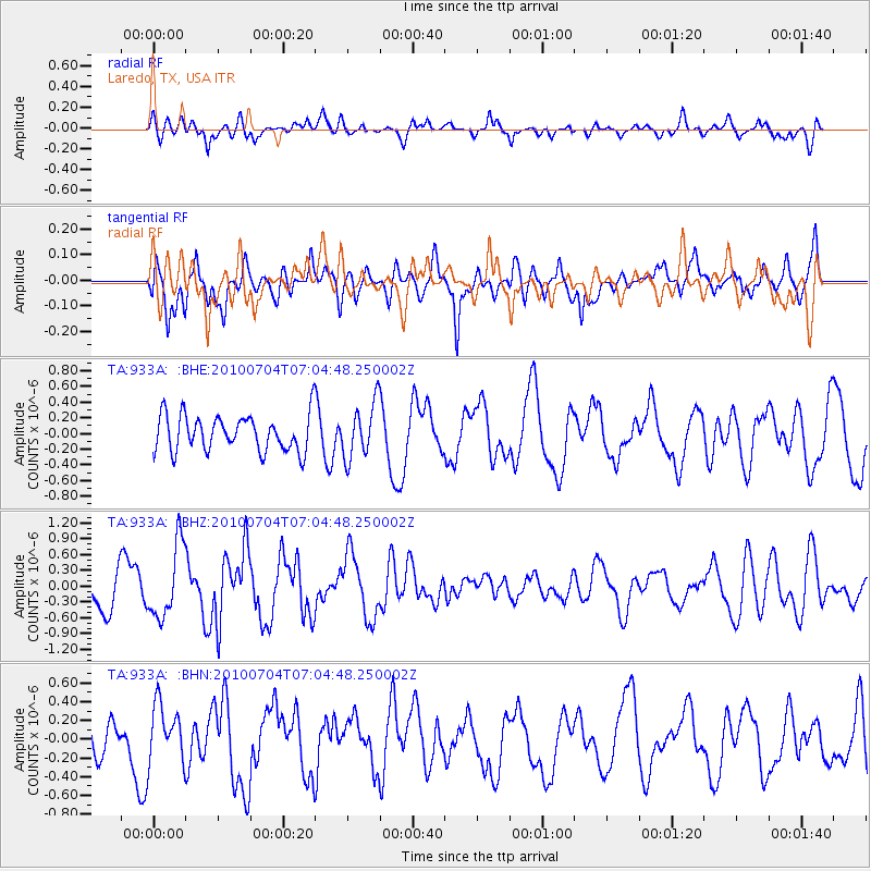
933A Laredo, TX, USA - Earthquake Result Viewer
*The percent match for this event was below the threshold and hence no stack was calculated.
| Earthquake location: |
Off Coast Of Northern Peru |
| Earthquake latitude/longitude: |
-8.5/-80.5 |
| Earthquake time(UTC): |
2010/07/04 (185) 06:57:44 GMT |
| Earthquake Depth: |
29 km |
| Earthquake Magnitude: |
5.7 MW, 5.3 MB, 5.6 MW |
| Earthquake Catalog/Contributor: |
WHDF/NEIC |
|
| Network: |
TA USArray Transportable Network (new EarthScope stations) |
| Station: |
933A Laredo, TX, USA |
| Lat/Lon: |
27.61 N/99.27 W |
| Elevation: |
214 m |
|
| Distance: |
40.2 deg |
| Az: |
333.711 deg |
| Baz: |
150.413 deg |
| Ray Param: |
$rayparam |
*The percent match for this event was below the threshold and hence was not used in the summary stack. |
|
| Radial Match: |
58.752567 % |
| Radial Bump: |
400 |
| Transverse Match: |
73.59143 % |
| Transverse Bump: |
400 |
| SOD ConfigId: |
319893 |
| Insert Time: |
2011-01-04 23:48:47.063 +0000 |
| GWidth: |
2.5 |
| Max Bumps: |
400 |
| Tol: |
0.001 |
|
Signal To Noise
| Channel | StoN | STA | LTA |
| TA:933A: :BHZ:20100704T07:04:48.250002Z | 2.2174163 | 6.966897E-7 | 3.1418986E-7 |
| TA:933A: :BHN:20100704T07:04:48.250002Z | 1.3158112 | 3.0283522E-7 | 2.3015099E-7 |
| TA:933A: :BHE:20100704T07:04:48.250002Z | 1.5220348 | 3.5084074E-7 | 2.3050771E-7 |
| Arrivals |
| Ps | |
| PpPs | |
| PsPs/PpSs | |


