You are here: Home > Network List > TA - USArray Transportable Network (new EarthScope stations) Stations List
> Station N34A Lincoln, NE, USA > Earthquake Result Viewer
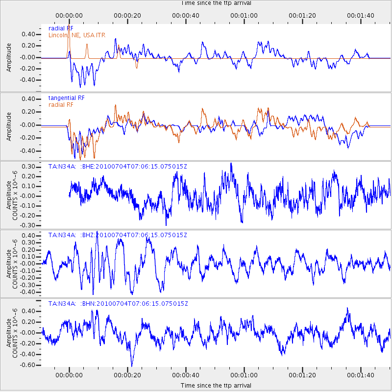
N34A Lincoln, NE, USA - Earthquake Result Viewer
*The percent match for this event was below the threshold and hence no stack was calculated.
| Earthquake location: |
Off Coast Of Northern Peru |
| Earthquake latitude/longitude: |
-8.5/-80.5 |
| Earthquake time(UTC): |
2010/07/04 (185) 06:57:44 GMT |
| Earthquake Depth: |
29 km |
| Earthquake Magnitude: |
5.7 MW, 5.3 MB, 5.6 MW |
| Earthquake Catalog/Contributor: |
WHDF/NEIC |
|
| Network: |
TA USArray Transportable Network (new EarthScope stations) |
| Station: |
N34A Lincoln, NE, USA |
| Lat/Lon: |
40.84 N/96.50 W |
| Elevation: |
401 m |
|
| Distance: |
51.2 deg |
| Az: |
344.414 deg |
| Baz: |
159.493 deg |
| Ray Param: |
$rayparam |
*The percent match for this event was below the threshold and hence was not used in the summary stack. |
|
| Radial Match: |
56.236267 % |
| Radial Bump: |
400 |
| Transverse Match: |
72.33427 % |
| Transverse Bump: |
400 |
| SOD ConfigId: |
319893 |
| Insert Time: |
2011-01-04 23:49:15.669 +0000 |
| GWidth: |
2.5 |
| Max Bumps: |
400 |
| Tol: |
0.001 |
|
Signal To Noise
| Channel | StoN | STA | LTA |
| TA:N34A: :BHZ:20100704T07:06:15.075015Z | 1.7894175 | 1.6289763E-7 | 9.10339E-8 |
| TA:N34A: :BHN:20100704T07:06:15.075015Z | 1.6314589 | 1.7316351E-7 | 1.0614029E-7 |
| TA:N34A: :BHE:20100704T07:06:15.075015Z | 1.8429912 | 1.5106073E-7 | 8.196498E-8 |
| Arrivals |
| Ps | |
| PpPs | |
| PsPs/PpSs | |


