You are here: Home > Network List > US - United States National Seismic Network Stations List
> Station EGMT Eagleton, Montana, USA > Earthquake Result Viewer
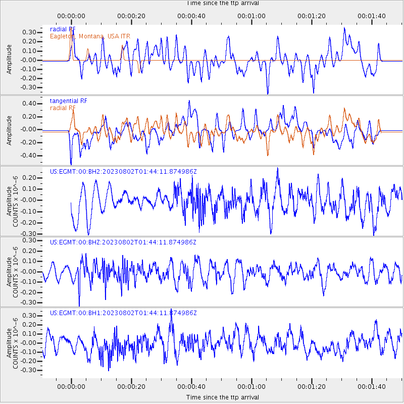
EGMT Eagleton, Montana, USA - Earthquake Result Viewer
*The percent match for this event was below the threshold and hence no stack was calculated.
| Earthquake location: |
Fiji Islands Region |
| Earthquake latitude/longitude: |
-21.6/-179.3 |
| Earthquake time(UTC): |
2023/08/02 (214) 01:32:35 GMT |
| Earthquake Depth: |
632 km |
| Earthquake Magnitude: |
5.8 mww |
| Earthquake Catalog/Contributor: |
NEIC PDE/us |
|
| Network: |
US United States National Seismic Network |
| Station: |
EGMT Eagleton, Montana, USA |
| Lat/Lon: |
48.02 N/109.75 W |
| Elevation: |
1055 m |
|
| Distance: |
93.0 deg |
| Az: |
39.025 deg |
| Baz: |
240.799 deg |
| Ray Param: |
$rayparam |
*The percent match for this event was below the threshold and hence was not used in the summary stack. |
|
| Radial Match: |
42.81608 % |
| Radial Bump: |
400 |
| Transverse Match: |
52.239983 % |
| Transverse Bump: |
400 |
| SOD ConfigId: |
31937991 |
| Insert Time: |
2023-08-16 02:00:55.942 +0000 |
| GWidth: |
2.5 |
| Max Bumps: |
400 |
| Tol: |
0.001 |
|
Signal To Noise
| Channel | StoN | STA | LTA |
| US:EGMT:00:BHZ:20230802T01:44:11.874986Z | 1.8115987 | 1.03228324E-7 | 5.6981893E-8 |
| US:EGMT:00:BH1:20230802T01:44:11.874986Z | 1.0452143 | 7.986037E-8 | 7.640574E-8 |
| US:EGMT:00:BH2:20230802T01:44:11.874986Z | 0.6330534 | 7.0780146E-8 | 1.11807545E-7 |
| Arrivals |
| Ps | |
| PpPs | |
| PsPs/PpSs | |


