HUMO Hull Mountain, OR - Earthquake Result Viewer
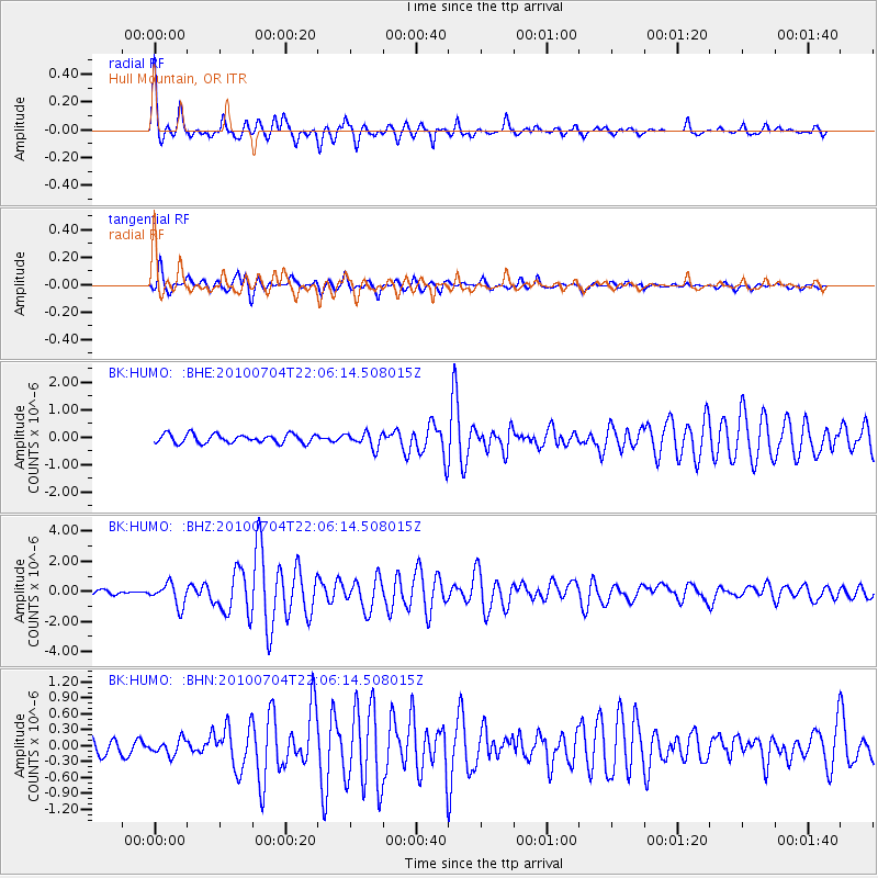
Earthquake location: Near East Coast Of Honshu, Japan
Earthquake latitude/longitude: 39.7/142.4
Earthquake time(UTC): 2010/07/04 (185) 21:55:51 GMT
Earthquake Depth: 27 km
Earthquake Magnitude: 6.4 MB, 6.1 MS, 6.3 MW, 6.2 MW
Earthquake Catalog/Contributor: WHDF/NEIC
Network: BK Berkeley Digital Seismograph Network
Station: HUMO Hull Mountain, OR
Lat/Lon: 42.61 N/122.96 W
Elevation: 555 m
Distance: 67.5 deg
Az: 52.792 deg
Baz: 303.661 deg
Ray Param: 0.056879222
Estimated Moho Depth: 65.75 km
Estimated Crust Vp/Vs: 2.01
Assumed Crust Vp: 6.522 km/s
Estimated Crust Vs: 3.253 km/s
Estimated Crust Poisson's Ratio: 0.33
Radial Match: 92.17861 %
Radial Bump: 400
Transverse Match: 80.32187 %
Transverse Bump: 400
SOD ConfigId: 319893
Insert Time: 2011-01-04 23:56:24.870 +0000
GWidth: 2.5
Max Bumps: 400
Tol: 0.001

Signal To Noise

ChannelStoNSTALTA
BK:HUMO: :BHZ:20100704T22:06:14.508015Z3.52633057.353444E-72.0852961E-7
BK:HUMO: :BHN:20100704T22:06:14.508015Z1.20078551.4492889E-71.2069506E-7
BK:HUMO: :BHE:20100704T22:06:14.508015Z1.70998882.751665E-71.6091714E-7
Arrivals
Ps11 SECOND
PpPs29 SECOND
PsPs/PpSs40 SECOND