FRB Iqaluit, Nunavut Territory, Canada - Earthquake Result Viewer
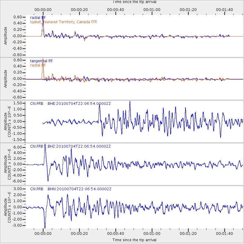
Earthquake location: Near East Coast Of Honshu, Japan
Earthquake latitude/longitude: 39.7/142.4
Earthquake time(UTC): 2010/07/04 (185) 21:55:51 GMT
Earthquake Depth: 27 km
Earthquake Magnitude: 6.4 MB, 6.1 MS, 6.3 MW, 6.2 MW
Earthquake Catalog/Contributor: WHDF/NEIC
Network: CN Canadian National Seismograph Network
Station: FRB Iqaluit, Nunavut Territory, Canada
Lat/Lon: 63.75 N/68.55 W
Elevation: 25 m
Distance: 74.0 deg
Az: 13.749 deg
Baz: 335.649 deg
Ray Param: 0.05258464
Estimated Moho Depth: 42.5 km
Estimated Crust Vp/Vs: 1.77
Assumed Crust Vp: 6.419 km/s
Estimated Crust Vs: 3.627 km/s
Estimated Crust Poisson's Ratio: 0.27
Radial Match: 95.99662 %
Radial Bump: 332
Transverse Match: 81.4808 %
Transverse Bump: 400
SOD ConfigId: 319893
Insert Time: 2011-01-05 00:00:16.958 +0000
GWidth: 2.5
Max Bumps: 400
Tol: 0.001

Signal To Noise

ChannelStoNSTALTA
CN:FRB: :BHZ:20100704T22:06:54.00002Z28.6654913.1303857E-61.09203974E-7
CN:FRB: :BHN:20100704T22:06:54.00002Z12.5419421.3241585E-61.0557843E-7
CN:FRB: :BHE:20100704T22:06:54.00002Z5.14253145.695534E-71.1075351E-7
Arrivals
Ps5.3 SECOND
PpPs18 SECOND
PsPs/PpSs23 SECOND