
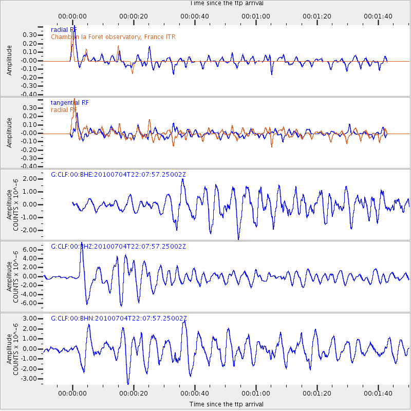
CLF Chambon la Foret observatory, France - Earthquake Result Viewer
| ||||||||||||||||||
| ||||||||||||||||||
| ||||||||||||||||||
|
Signal To Noise
| Channel | StoN | STA | LTA |
| G:CLF:00:BHZ:20100704T22:07:57.25002Z | 10.907649 | 3.3227684E-6 | 3.0462738E-7 |
| G:CLF:00:BHN:20100704T22:07:57.25002Z | 2.0570571 | 1.014859E-6 | 4.933548E-7 |
| G:CLF:00:BHE:20100704T22:07:57.25002Z | 2.907889 | 9.1515113E-7 | 3.1471325E-7 |
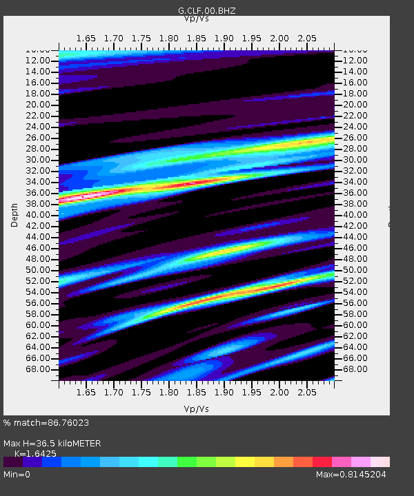
| Arrivals | |
| Ps | 3.9 SECOND |
| PpPs | 15 SECOND |
| PsPs/PpSs | 19 SECOND |

